Get the draw status of your map view or scene view to know when all layers in the map or scene have finished drawing.
Use case
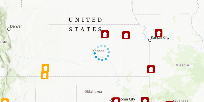
You may want to display a loading indicator while layers are loading, which displays on DrawStatus.IN_PROGRESS.
How to use the sample
Pan and zoom around the map. Observe how the progress indicator is displayed and then hidden, indicating when drawing has completed.
How it works
- Create a
MapViewand a progress indicator. - Bind the visibility of the progress indicator to the
drawStatusProperty.
Relevant API
- ArcGISMap
- DrawStatus
- MapView
Tags
draw, loading, map, render
Sample Code
/* * Copyright 2022 Esri. * * Licensed under the Apache License, Version 2.0 (the "License"); * you may not use this file except in compliance with the License. * You may obtain a copy of the License at * * http://www.apache.org/licenses/LICENSE-2.0 * * Unless required by applicable law or agreed to in writing, software * distributed under the License is distributed on an "AS IS" BASIS, * WITHOUT WARRANTIES OR CONDITIONS OF ANY KIND, either express or implied. * See the License for the specific language governing permissions and * limitations under the License. */
module com.esri.samples.display_drawing_status {  // require ArcGIS Maps SDK for Java module  requires com.esri.arcgisruntime;
  // handle SLF4J http://www.slf4j.org/codes.html#StaticLoggerBinder  requires org.slf4j.nop;
  // require JavaFX modules that the application uses  requires javafx.controls;  requires javafx.graphics;
  exports com.esri.samples.display_drawing_status;}
/* * Copyright 2017 Esri. * * Licensed under the Apache License, Version 2.0 (the "License"); you may not * use this file except in compliance with the License. You may obtain a copy of * the License at * * http://www.apache.org/licenses/LICENSE-2.0 * * Unless required by applicable law or agreed to in writing, software * distributed under the License is distributed on an "AS IS" BASIS, WITHOUT * WARRANTIES OR CONDITIONS OF ANY KIND, either express or implied. See the * License for the specific language governing permissions and limitations under * the License. */
package com.esri.samples.display_drawing_status;
import javafx.application.Application;import javafx.geometry.Pos;import javafx.scene.Scene;import javafx.scene.control.ProgressIndicator;import javafx.scene.layout.StackPane;import javafx.stage.Stage;
import com.esri.arcgisruntime.ArcGISRuntimeEnvironment;import com.esri.arcgisruntime.data.ServiceFeatureTable;import com.esri.arcgisruntime.geometry.Envelope;import com.esri.arcgisruntime.geometry.Point;import com.esri.arcgisruntime.geometry.SpatialReferences;import com.esri.arcgisruntime.layers.FeatureLayer;import com.esri.arcgisruntime.mapping.ArcGISMap;import com.esri.arcgisruntime.mapping.BasemapStyle;import com.esri.arcgisruntime.mapping.Viewpoint;import com.esri.arcgisruntime.mapping.view.DrawStatus;import com.esri.arcgisruntime.mapping.view.MapView;
public class DisplayDrawingStatusSample extends Application {
private MapView mapView;
@Override public void start(Stage stage) {
try { // create stack pane and application scene StackPane stackPane = new StackPane(); Scene scene = new Scene(stackPane);
// set title, size, and add scene to stage stage.setTitle("Display Drawing Status Sample"); stage.setWidth(800); stage.setHeight(700); stage.setScene(scene); stage.show();
// authentication with an API key or named user is required to access basemaps and other location services String yourAPIKey = System.getProperty("apiKey"); ArcGISRuntimeEnvironment.setApiKey(yourAPIKey);
// create progress indicator var progressIndicator = new ProgressIndicator();
// create a map with the topographic basemap style final ArcGISMap map = new ArcGISMap(BasemapStyle.ARCGIS_TOPOGRAPHIC);
// create a feature table from a service URL final ServiceFeatureTable featureTable = new ServiceFeatureTable( "https://sampleserver6.arcgisonline.com/arcgis/rest/services/DamageAssessment/FeatureServer/0");
// create a feature layer from service table final FeatureLayer featureLayer = new FeatureLayer(featureTable);
// add the feature layer to the map's operational layers map.getOperationalLayers().add(featureLayer);
// create a map view and set the map to it mapView = new MapView(); mapView.setMap(map);
// create a viewpoint and set it to the map view Point bottomLeftPoint = new Point(-1.5054808160556655E7, 2718975.702666207, SpatialReferences.getWebMercator()); Point topRightPoint = new Point(-6810317.90634398, 6850505.377826911, SpatialReferences.getWebMercator()); Envelope envelope = new Envelope(bottomLeftPoint, topRightPoint); mapView.setViewpoint(new Viewpoint(envelope));
// bind progress indicator visibility to map view draw status progressIndicator.visibleProperty().bind(mapView.drawStatusProperty().isEqualTo(DrawStatus.IN_PROGRESS));
// add the map view and progress indicator to stack pane stackPane.getChildren().addAll(mapView, progressIndicator); StackPane.setAlignment(progressIndicator, Pos.CENTER); } catch (Exception e) { // on any error, display the stack trace e.printStackTrace(); } }
/** * Stops and releases all resources used in application. */ @Override public void stop() {
if (mapView != null) { mapView.dispose(); } }
/** * Opens and runs application. * * @param args arguments passed to this application */ public static void main(String[] args) {
Application.launch(args); }
}