Create graphics from an XML file with key-value pairs for each graphic, and display the military symbols using a MIL-STD-2525D web style in 2D.
Use case
Use a dictionary renderer on a graphics overlay to display more transient data, such as military messages coming through a local tactical network.
How to use the sample
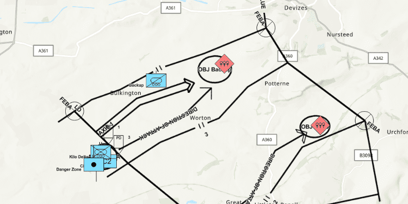
Run the sample and view the military symbols on the map.
How it works
- Create a new
DictionarySymbolStyle(portalItem)with a portal item containing a MIL-STD-2525D dictionary web style. - Create a new
DictionaryRendererfrom the dictionary symbol style. - Create a new
GraphicsOverlay. - Set the dictionary renderer to the graphics overlay.
- Parse through the local XML file creating a map of key/value pairs for each block of attributes.
- Create a
Graphicfor each attribute. - Use the
_wkidkey to get the geometry's spatial reference. - Use the
_control_pointskey to get the geometry's shape. - Add the graphic to the graphics overlay.
Relevant API
- DictionaryRenderer
- DictionarySymbolStyle
- GraphicsOverlay
About the data
The dictionary symbol style in this sample is constructed from a portal item containing a MIL-STD-2525D symbol dictionary web style. This ArcGIS Web Style is used to build custom applications that incorporate the MIL-STD-2525D symbol dictionary. This style supports a configuration for modeling locations as ordered anchor points or full geometries.
Tags
defense, military, situational awareness, tactical, visualization
Sample Code
/*
* Copyright 2017 Esri.
*
* Licensed under the Apache License, Version 2.0 (the "License"); you may not
* use this file except in compliance with the License. You may obtain a copy of
* the License at
*
* http://www.apache.org/licenses/LICENSE-2.0
*
* Unless required by applicable law or agreed to in writing, software
* distributed under the License is distributed on an "AS IS" BASIS, WITHOUT
* WARRANTIES OR CONDITIONS OF ANY KIND, either express or implied. See the
* License for the specific language governing permissions and limitations under
* the License.
*/
package com.esri.samples.dictionary_renderer_graphics_overlay;
import javafx.application.Application;
import javafx.scene.Scene;
import javafx.scene.control.Alert;
import javafx.scene.layout.StackPane;
import javafx.stage.Stage;
import org.w3c.dom.Node;
import org.w3c.dom.NodeList;
import javax.xml.parsers.DocumentBuilderFactory;
import java.io.File;
import java.util.*;
import java.util.stream.Collectors;
import java.util.stream.Stream;
import com.esri.arcgisruntime.ArcGISRuntimeEnvironment;
import com.esri.arcgisruntime.geometry.Multipoint;
import com.esri.arcgisruntime.geometry.Point;
import com.esri.arcgisruntime.geometry.PointCollection;
import com.esri.arcgisruntime.geometry.SpatialReference;
import com.esri.arcgisruntime.loadable.LoadStatus;
import com.esri.arcgisruntime.mapping.ArcGISMap;
import com.esri.arcgisruntime.mapping.BasemapStyle;
import com.esri.arcgisruntime.mapping.view.Graphic;
import com.esri.arcgisruntime.mapping.view.GraphicsOverlay;
import com.esri.arcgisruntime.mapping.view.MapView;
import com.esri.arcgisruntime.portal.Portal;
import com.esri.arcgisruntime.portal.PortalItem;
import com.esri.arcgisruntime.symbology.DictionaryRenderer;
import com.esri.arcgisruntime.symbology.DictionarySymbolStyle;
public class DictionaryRendererGraphicsOverlaySample extends Application {
private MapView mapView;
private GraphicsOverlay graphicsOverlay;
@Override
public void start(Stage stage) {
try {
// create stack pane and application scene
var stackPane = new StackPane();
var scene = new Scene(stackPane);
// set title, size, and add scene to stage
stage.setTitle("Dictionary Renderer Graphics Overlay Sample");
stage.setWidth(800);
stage.setHeight(700);
stage.setScene(scene);
stage.show();
// authentication with an API key or named user is required to access basemaps and other location services
String yourAPIKey = System.getProperty("apiKey");
ArcGISRuntimeEnvironment.setApiKey(yourAPIKey);
// create a map view
mapView = new MapView();
// create a map with the topographic basemap style
ArcGISMap map = new ArcGISMap(BasemapStyle.ARCGIS_TOPOGRAPHIC);
graphicsOverlay = new GraphicsOverlay();
// graphics no longer show after zooming passed this scale
graphicsOverlay.setMinScale(1000000);
mapView.getGraphicsOverlays().add(graphicsOverlay);
// create the dictionary symbol style from the Joint Military Symbology MIL-STD-2525D portal item
var portalItem = new PortalItem(new Portal("https://www.arcgis.com/", false), "d815f3bdf6e6452bb8fd153b654c94ca");
var dictionarySymbolStyle = new DictionarySymbolStyle(portalItem);
// add done loading listeners to the map and dictionary symbol style and check they have loaded
map.addDoneLoadingListener(() -> {
if (map.getLoadStatus() == LoadStatus.LOADED) {
dictionarySymbolStyle.addDoneLoadingListener(() -> {
if (dictionarySymbolStyle.getLoadStatus() == LoadStatus.LOADED) {
// find the first configuration setting which has the property name "model",
// and set its value to "ORDERED ANCHOR POINTS"
dictionarySymbolStyle.getConfigurations().stream()
.filter(configuration -> configuration.getName().equals("model"))
.findFirst()
.ifPresent(modelConfiguration -> modelConfiguration.setValue("ORDERED ANCHOR POINTS"));
// create a new dictionary renderer from the dictionary symbol style to render graphics
// with symbol dictionary attributes and set it to the graphics overlay renderer
var dictionaryRenderer = new DictionaryRenderer(dictionarySymbolStyle);
graphicsOverlay.setRenderer(dictionaryRenderer);
// parse graphic attributes from an XML file following the mil2525d specification
try {
List<Map<String, Object>> messages = parseMessages();
// create graphics with attributes and add to graphics overlay
List<Graphic> graphics = messages.stream()
.map(DictionaryRendererGraphicsOverlaySample::createGraphic)
.collect(Collectors.toList());
graphicsOverlay.getGraphics().addAll(graphics);
// set the viewpoint to the extent of the graphics overlay
mapView.setViewpointGeometryAsync(graphicsOverlay.getExtent());
} catch (Exception e) {
e.printStackTrace();
}
} else {
new Alert(Alert.AlertType.ERROR,
"Failed to load symbol style " + dictionarySymbolStyle.getLoadError().getCause().getMessage()).show();
}
});
} else {
new Alert(Alert.AlertType.ERROR, "Map failed to load" + map.getLoadError().getCause().getMessage()).show();
}
// load the dictionary symbol style once the map has loaded
dictionarySymbolStyle.loadAsync();
});
// set the map to the map view and add the map view to the stack pane
mapView.setMap(map);
stackPane.getChildren().add(mapView);
} catch (Exception ex) {
// on any exception, print the stacktrace
ex.printStackTrace();
}
}
/**
* Parses a XML file following the mil2525d specification and creates a message for each block of attributes found.
*/
private List<Map<String, Object>> parseMessages() throws Exception {
File mil2525dFile = new File(System.getProperty("data.dir"), "./samples-data/xml/Mil2525DMessages.xml");
var documentBuilderFactory = DocumentBuilderFactory.newInstance();
var documentBuilder = documentBuilderFactory.newDocumentBuilder();
var document = documentBuilder.parse(mil2525dFile);
document.getDocumentElement().normalize();
final List<Map<String, Object>> messages = new ArrayList<>();
for (int i = 0; i < document.getElementsByTagName("message").getLength(); i++) {
Node message = document.getElementsByTagName("message").item(i);
Map<String, Object> attributes = new HashMap<>();
NodeList childNodes = message.getChildNodes();
for (int j = 0; j < childNodes.getLength(); j++) {
attributes.put(childNodes.item(j).getNodeName(), childNodes.item(j).getTextContent());
}
messages.add(attributes);
}
return messages;
}
/**
* Creates a graphic using a symbol dictionary and the attributes that were passed.
*
* @param attributes tells symbol dictionary what symbol to apply to graphic
*/
private static Graphic createGraphic(Map<String, Object> attributes) {
// get spatial reference
int wkid = Integer.parseInt((String) attributes.get("_wkid"));
SpatialReference sr = SpatialReference.create(wkid);
// get points from the coordinate string in the "_control_points" attribute (delimited with ';')
PointCollection points = new PointCollection(sr);
String[] coordinates = ((String) attributes.get("_control_points")).split(";");
Stream.of(coordinates)
.map(cs -> cs.split(","))
.map(c -> new Point(Double.parseDouble(c[0]), Double.parseDouble(c[1]), sr))
.collect(Collectors.toCollection(() -> points));
// return a graphic with multipoint geometry
return new Graphic(new Multipoint(points), attributes);
}
/**
* Stops and releases all resources used in application.
*/
@Override
public void stop() {
if (mapView != null) {
mapView.dispose();
}
}
/**
* Opens and runs application.
*
* @param args arguments passed to this application
*/
public static void main(String[] args) {
Application.launch(args);
}
}