Find the location for an address.
Use case
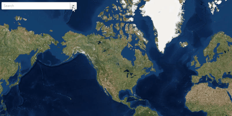
A user can input a raw address into your app's search bar and zoom to the address location.
How to use the sample
Select an entry from the drop-down menu at the top left of the screen to zoom to the address, marked with a pin.
How it works
- Create a
LocatorTaskusing the URL to a locator service. - Set the
GeocodeParametersfor the locator task and specify the geocode's attributes. - Get the matching results from the
GeocodeResultusinglocatorTask.geocodeAsync(addressString, geocodeParameters). - Create a
Graphicwith the geocode result's location and store the geocode result's attributes in the graphic's attributes. - Show the graphic in a
GraphicsOverlay.
Relevant API
- GeocodeParameters
- GeocodeResult
- LocatorTask
Additional information
This sample uses the World Geocoding Service. For more information, see the Geocoding service help topic on the ArcGIS Developer website.
Tags
address, geocode, locator, search
Sample Code
FindAddressSample.java
/*
* Copyright 2017 Esri.
*
* Licensed under the Apache License, Version 2.0 (the "License"); you may not
* use this file except in compliance with the License. You may obtain a copy of
* the License at
*
* http://www.apache.org/licenses/LICENSE-2.0
*
* Unless required by applicable law or agreed to in writing, software
* distributed under the License is distributed on an "AS IS" BASIS, WITHOUT
* WARRANTIES OR CONDITIONS OF ANY KIND, either express or implied. See the
* License for the specific language governing permissions and limitations under
* the License.
*/
package com.esri.samples.find_address;
import java.util.HashMap;
import java.util.List;
import java.util.concurrent.ExecutionException;
import javafx.application.Application;
import javafx.application.Platform;
import javafx.event.ActionEvent;
import javafx.geometry.Insets;
import javafx.geometry.Point2D;
import javafx.geometry.Pos;
import javafx.scene.Scene;
import javafx.scene.control.ComboBox;
import javafx.scene.image.Image;
import javafx.scene.layout.StackPane;
import javafx.stage.Stage;
import javafx.util.Duration;
import com.esri.arcgisruntime.ArcGISRuntimeEnvironment;
import com.esri.arcgisruntime.concurrent.ListenableFuture;
import com.esri.arcgisruntime.geometry.Point;
import com.esri.arcgisruntime.mapping.ArcGISMap;
import com.esri.arcgisruntime.mapping.BasemapStyle;
import com.esri.arcgisruntime.mapping.Viewpoint;
import com.esri.arcgisruntime.mapping.view.Callout;
import com.esri.arcgisruntime.mapping.view.Callout.LeaderPosition;
import com.esri.arcgisruntime.mapping.view.Graphic;
import com.esri.arcgisruntime.mapping.view.GraphicsOverlay;
import com.esri.arcgisruntime.mapping.view.MapView;
import com.esri.arcgisruntime.symbology.PictureMarkerSymbol;
import com.esri.arcgisruntime.tasks.geocode.GeocodeParameters;
import com.esri.arcgisruntime.tasks.geocode.GeocodeResult;
import com.esri.arcgisruntime.tasks.geocode.LocatorTask;
public class FindAddressSample extends Application {
private MapView mapView;
private LocatorTask locatorTask;
private GraphicsOverlay graphicsOverlay;
private PictureMarkerSymbol pinSymbol;
private ComboBox<String> searchBox;
@Override
public void start(Stage stage) {
try {
// create stack pane and application scene
StackPane stackPane = new StackPane();
Scene scene = new Scene(stackPane);
// set title, size, and add scene to stage
stage.setTitle("Find Address Sample");
stage.setWidth(800);
stage.setHeight(700);
stage.setScene(scene);
stage.show();
// authentication with an API key or named user is required to access basemaps and other location services
String yourAPIKey = System.getProperty("apiKey");
ArcGISRuntimeEnvironment.setApiKey(yourAPIKey);
// create search box
searchBox = new ComboBox<>();
searchBox.setPromptText("Search");
searchBox.setEditable(true);
searchBox.setMaxWidth(260.0);
// add example locations
String[] examples = {
"277 N Avenida Caballeros, Palm Springs, CA", "380 New York St, Redlands, CA 92373", "Београд", "Москва", "北京"
};
searchBox.getItems().addAll(examples);
// create a map with the standard imagery basemap style
ArcGISMap map = new ArcGISMap(BasemapStyle.ARCGIS_IMAGERY_STANDARD);
// create a map view and set the map to it
mapView = new MapView();
mapView.setMap(map);
// set a viewpoint on the map view
mapView.setViewpoint(new Viewpoint(48.354406, -99.998267, 147914382));
// add a graphics overlay
graphicsOverlay = new GraphicsOverlay();
mapView.getGraphicsOverlays().add(graphicsOverlay);
// set the callout's default style
Callout callout = mapView.getCallout();
callout.setLeaderPosition(LeaderPosition.BOTTOM);
// create a locatorTask
locatorTask = new LocatorTask("https://geocode-api.arcgis.com/arcgis/rest/services/World/GeocodeServer");
// create geocode task parameters
GeocodeParameters geocodeParameters = new GeocodeParameters();
// return all attributes
geocodeParameters.getResultAttributeNames().add("*");
geocodeParameters.setMaxResults(1); // get closest match
geocodeParameters.setOutputSpatialReference(mapView.getSpatialReference());
// create a pin graphic
Image img = new Image(getClass().getResourceAsStream("/pin.png"), 0, 80, true, true);
pinSymbol = new PictureMarkerSymbol(img);
pinSymbol.loadAsync();
// event to get geocode when query is submitted
searchBox.setOnAction((ActionEvent evt) -> {
// get the user's query
String query;
if (searchBox.getSelectionModel().getSelectedIndex() == -1) {
// user supplied their own query
query = searchBox.getEditor().getText();
} else {
// user chose a suggested query
query = searchBox.getSelectionModel().getSelectedItem();
}
if (!query.equals("")) {
// hide callout if showing
mapView.getCallout().dismiss();
// run the locatorTask geocode task
ListenableFuture<List<GeocodeResult>> results = locatorTask.geocodeAsync(query, geocodeParameters);
// add a listener to display the result when loaded
results.addDoneListener(new ResultsLoadedListener(results));
}
});
// add map view and control panel to stack pane
stackPane.getChildren().addAll(mapView, searchBox);
StackPane.setAlignment(searchBox, Pos.TOP_LEFT);
StackPane.setMargin(searchBox, new Insets(10, 0, 0, 10));
} catch (Exception e) {
// on any error, print the stack trace
e.printStackTrace();
}
}
/**
* Runnable listener to update marker and callout when new results are loaded.
*/
private class ResultsLoadedListener implements Runnable {
private final ListenableFuture<List<GeocodeResult>> results;
/**
* Constructs a runnable listener for the geocode results.
*
* @param results results from a {@link LocatorTask#geocodeAsync} task
*/
ResultsLoadedListener(ListenableFuture<List<GeocodeResult>> results) {
this.results = results;
}
@Override
public void run() {
try {
List<GeocodeResult> geocodes = results.get();
if (geocodes.size() > 0) {
// get the top result
GeocodeResult geocode = geocodes.get(0);
// get attributes from the result for the callout
String addrType = geocode.getAttributes().get("Addr_type").toString();
String placeName = geocode.getAttributes().get("PlaceName").toString();
String placeAddr = geocode.getAttributes().get("Place_addr").toString();
String matchAddr = geocode.getAttributes().get("Match_addr").toString();
String locType = geocode.getAttributes().get("Type").toString();
// format callout details
String title;
String detail;
switch (addrType) {
case "POI":
title = placeName.equals("") ? "" : placeName;
if (!placeAddr.equals("")) {
detail = placeAddr;
} else if (!matchAddr.equals("") && !locType.equals("")) {
detail = !matchAddr.contains(",") ? locType : matchAddr.substring(matchAddr.indexOf(", ") + 2);
} else {
detail = "";
}
break;
case "StreetName":
case "PointAddress":
case "Postal":
if (matchAddr.contains(",")) {
title = matchAddr.equals("") ? "" : matchAddr.split(",")[0];
detail = matchAddr.equals("") ? "" : matchAddr.substring(matchAddr.indexOf(", ") + 2);
break;
}
default:
title = "";
detail = matchAddr.equals("") ? "" : matchAddr;
}
HashMap<String, Object> attributes = new HashMap<>();
attributes.put("title", title);
attributes.put("detail", detail);
// create the marker
Graphic marker = new Graphic(geocode.getDisplayLocation(), attributes, pinSymbol);
// set the viewpoint to the marker
Point location = geocodes.get(0).getDisplayLocation();
mapView.setViewpointCenterAsync(location, 10000);
// update the marker
Platform.runLater(() -> {
// clear out previous results
graphicsOverlay.getGraphics().clear();
searchBox.hide();
// add the marker to the graphics overlay
graphicsOverlay.getGraphics().add(marker);
// display the callout
Callout callout = mapView.getCallout();
callout.setTitle(marker.getAttributes().get("title").toString());
callout.setDetail(marker.getAttributes().get("detail").toString());
callout.showCalloutAt(location, new Point2D(0, -24), Duration.ZERO);
});
}
} catch (InterruptedException | ExecutionException e) {
e.printStackTrace();
}
}
}
/**
* Stops and releases all resources used in application.
*/
@Override
public void stop() {
// release resources when the application closes
if (mapView != null) {
mapView.dispose();
}
}
/**
* Opens and runs application.
*
* @param args arguments passed to this application
*/
public static void main(String[] args) {
Application.launch(args);
}
}