Load a WFS feature table using an XML query.
Use case
ArcGIS Maps SDKs for Native Apps QueryParameters objects can't represent all possible queries that can be made against a WFS feature service. For example, ArcGIS Maps SDKs for Native Apps query parameters don't support wildcard searches. You can provide queries as raw XML strings, allowing you to access query functionality not available with QueryParameters.
How to use the sample
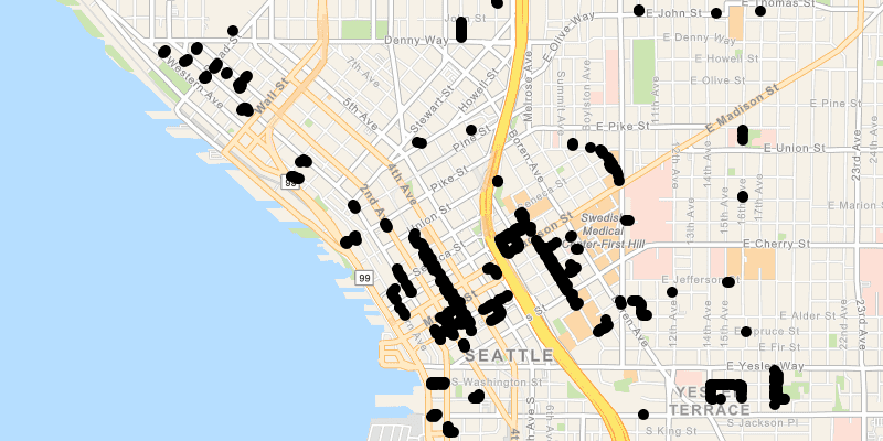
Run the sample and view the data loaded from the WFS feature table.
How it works
- Create a
WfsFeatureTableand aFeatureLayerto visualize the table. - Set the feature request mode to
ManualCache. - Call
populateFromServiceAsync()to populate the table with only those features returned by the XML query.
Relevant API
- FeatureLayer
- WfsFeatureTable
About the data
This service shows trees in downtown Seattle and the surrounding area. An XML-encoded GetFeature request is used to limit results to only trees of the genus Tilia.
For additional information, see the underlying service on ArcGIS Online.
Tags
feature, OGC, query, service, web, WFS, XML
Sample Code
/*
* Copyright 2019 Esri.
*
* Licensed under the Apache License, Version 2.0 (the "License"); you may not
* use this file except in compliance with the License. You may obtain a copy of
* the License at
*
* http://www.apache.org/licenses/LICENSE-2.0
*
* Unless required by applicable law or agreed to in writing, software
* distributed under the License is distributed on an "AS IS" BASIS, WITHOUT
* WARRANTIES OR CONDITIONS OF ANY KIND, either express or implied. See the
* License for the specific language governing permissions and limitations under
* the License.
*/
package com.esri.samples.wfs_xml_query;
import java.io.IOException;
import java.nio.charset.StandardCharsets;
import javafx.application.Application;
import javafx.scene.Scene;
import javafx.scene.control.ProgressIndicator;
import javafx.scene.layout.StackPane;
import javafx.stage.Stage;
import com.esri.arcgisruntime.ArcGISRuntimeEnvironment;
import com.esri.arcgisruntime.data.ServiceFeatureTable;
import com.esri.arcgisruntime.layers.FeatureLayer;
import com.esri.arcgisruntime.mapping.ArcGISMap;
import com.esri.arcgisruntime.mapping.BasemapStyle;
import com.esri.arcgisruntime.mapping.view.MapView;
import com.esri.arcgisruntime.ogc.wfs.OgcAxisOrder;
import com.esri.arcgisruntime.ogc.wfs.WfsFeatureTable;
import org.apache.commons.io.IOUtils;
public class WfsXmlQuerySample extends Application {
private MapView mapView;
@Override
public void start(Stage stage) throws IOException {
// create stack pane and JavaFX app scene
StackPane stackPane = new StackPane();
Scene scene = new Scene(stackPane);
// set title, size, and add JavaFX scene to stage
stage.setTitle("Load WFS with XML Query");
stage.setWidth(800);
stage.setHeight(700);
stage.setScene(scene);
stage.show();
// authentication with an API key or named user is required to access basemaps and other location services
String yourAPIKey = System.getProperty("apiKey");
ArcGISRuntimeEnvironment.setApiKey(yourAPIKey);
// create a progress indicator
ProgressIndicator progressIndicator = new ProgressIndicator();
progressIndicator.setVisible(true);
// create a map with the navigation basemap style
ArcGISMap map = new ArcGISMap(BasemapStyle.ARCGIS_NAVIGATION);
// create a map view and set the map to it
mapView = new MapView();
mapView.setMap(map);
// create a feature table from the WFS service URL and layer name
WfsFeatureTable wfsFeatureTable = new WfsFeatureTable(
"https://dservices2.arcgis.com/ZQgQTuoyBrtmoGdP/arcgis/services/Seattle_Downtown_Features/WFSServer?service=wfs&request=getcapabilities",
"Seattle_Downtown_Features:Trees");
// set the feature request mode and axis order
wfsFeatureTable.setAxisOrder(OgcAxisOrder.NO_SWAP);
wfsFeatureTable.setFeatureRequestMode(ServiceFeatureTable.FeatureRequestMode.MANUAL_CACHE);
// create a feature layer to visualize the WFS features
FeatureLayer wfsFeatureLayer = new FeatureLayer(wfsFeatureTable);
// add the layer to the map's operational layers
map.getOperationalLayers().add(wfsFeatureLayer);
// create an XML query to retrieve trees of genus Tilia.
// To learn more about specifying filters in OGC technologies, see https://www.opengeospatial.org/standards/filter.
String xmlQuery = IOUtils.toString(WfsXmlQuerySample.class.getResourceAsStream("/SeattleTreeQuery.xml"), StandardCharsets.UTF_8.name());
// populate the WFS feature table with XML query
wfsFeatureTable.populateFromServiceAsync(xmlQuery, true).addDoneListener(() -> {
// set the viewpoint of the map view to the extent reported by the feature layer
mapView.setViewpointGeometryAsync(wfsFeatureLayer.getFullExtent(), 50);
progressIndicator.setVisible(false);
});
// add the map view to the stack pane
stackPane.getChildren().addAll(mapView, progressIndicator);
}
/**
* Stops and releases all resources used in application.
*/
@Override
public void stop() {
if (mapView != null) {
mapView.dispose();
}
}
/**
* Opens and runs application.
*
* @param args arguments passed to this application
*/
public static void main(String[] args) {
Application.launch(args);
}
}