Create a feature collection layer to show a query result from a service feature table.
Use case
Consider a national wireless telecommunications company who wants to improve connectivity within areas of poor coverage. Their cell towers, cell tower radii and state boundaries data are held within service feature tables, which can be queried for states that don’t meet a certain threshold of coverage. The query result can be used to create and display a single feature collection layer for analysis of areas requiring improved coverage.
How to use the sample
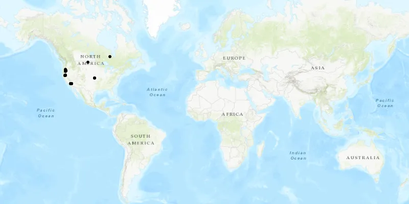
When launched, this sample displays a map with point features as a feature collection layer. Pan and zoom to explore the map.
How it works
- Perform a query using the
.queryFeatures()method on aServiceFeatureTable. - Instantiate a
FeatureCollectionTablewith the result of the query. - Create a
FeatureCollectionand add the feature collection table to it. - Create a
FeatureCollectionLayerfrom the feature collection. - Add the feature collection layer to the map’s
operationalLayerslist.
Relevant API
- FeatureCollection
- FeatureCollectionLayer
- FeatureCollectionTable
- FeatureLayer
- FeatureQueryResult
- FeatureTable
- QueryParameters
- ServiceFeatureTable
About the data
This application utilizes data from the wildfire feature service. It loads at full extent with features indicating wildfire response point features across the world.
Tags
layer, query, search, table
Sample code
/* * Copyright 2018 Esri. * * Licensed under the Apache License, Version 2.0 (the "License"); you may not * use this file except in compliance with the License. You may obtain a copy of * the License at * * http://www.apache.org/licenses/LICENSE-2.0 * * Unless required by applicable law or agreed to in writing, software * distributed under the License is distributed on an "AS IS" BASIS, WITHOUT * WARRANTIES OR CONDITIONS OF ANY KIND, either express or implied. See the * License for the specific language governing permissions and limitations under * the License. */
package com.esri.samples.feature_collection_layer_query;
import com.esri.arcgisruntime.ArcGISRuntimeEnvironment;import com.esri.arcgisruntime.concurrent.ListenableFuture;import com.esri.arcgisruntime.data.FeatureCollection;import com.esri.arcgisruntime.data.FeatureCollectionTable;import com.esri.arcgisruntime.data.FeatureQueryResult;import com.esri.arcgisruntime.data.FeatureTable;import com.esri.arcgisruntime.data.QueryParameters;import com.esri.arcgisruntime.data.ServiceFeatureTable;import com.esri.arcgisruntime.layers.FeatureCollectionLayer;import com.esri.arcgisruntime.mapping.ArcGISMap;import com.esri.arcgisruntime.mapping.BasemapStyle;import com.esri.arcgisruntime.mapping.view.MapView;import javafx.application.Application;import javafx.scene.Scene;import javafx.scene.layout.StackPane;import javafx.stage.Stage;
public class FeatureCollectionLayerQuerySample extends Application {
  private MapView mapView;
  @Override  public void start(Stage stage) {
    try {      // create stackpane and application scene      StackPane stackPane = new StackPane();      Scene scene = new Scene(stackPane);
      // set title, size, and add scene to stage      stage.setTitle("Feature Collection Layer Query Sample");      stage.setWidth(800);      stage.setHeight(700);      stage.setScene(scene);      stage.show();
      // authentication with an API key or named user is required to access basemaps and other location services      String yourAPIKey = System.getProperty("apiKey");      ArcGISRuntimeEnvironment.setApiKey(yourAPIKey);
      // create a map with the topographic basemap style      ArcGISMap map = new ArcGISMap(BasemapStyle.ARCGIS_TOPOGRAPHIC);
      // create a map view and set the map to it      mapView = new MapView();      mapView.setMap(map);
      // initialize service feature table to be queried (in this sample, wild fire response points)      FeatureTable featureTable = new ServiceFeatureTable("https://sampleserver6.arcgisonline.com/arcgis/rest/services/Wildfire/FeatureServer/0");
      // create query parameters      QueryParameters queryParams = new QueryParameters();      queryParams.setWhereClause("1=1"); // 1=1 will give all the features from the table
      // query feature from the table      ListenableFuture<FeatureQueryResult> queryResultListenableFuture = featureTable.queryFeaturesAsync(queryParams);      queryResultListenableFuture.addDoneListener(() -> {
        try {          // create a feature collection table from the query results          FeatureCollectionTable featureCollectionTable = new FeatureCollectionTable(queryResultListenableFuture.get());
          // create a feature collection from the above feature collection table          FeatureCollection featureCollection = new FeatureCollection();          featureCollection.getTables().add(featureCollectionTable);
          // create a feature collection layer with the above feature collection          FeatureCollectionLayer featureCollectionLayer = new FeatureCollectionLayer(featureCollection);
          // add the feature collection layer to the map's operational layers          mapView.getMap().getOperationalLayers().add(featureCollectionLayer);
        } catch (Exception e) {          // on any error, display the stack trace          e.printStackTrace();        }      });
      // add the map view to the stack pane      stackPane.getChildren().add(mapView);
    } catch (Exception e) {      // on any error, display the stack trace      e.printStackTrace();    }  }
  /**   * Stops and releases all resources used in application.   */  @Override  public void stop() {
    if (mapView != null) {      mapView.dispose();    }  }
  /**   * Opens and runs application.   *   * @param args arguments passed to this application   */  public static void main(String[] args) {
    Application.launch(args);  }}