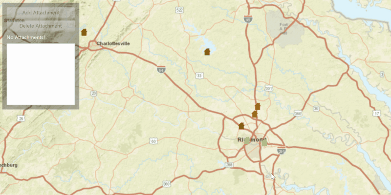
Add, delete, and download attachments for features from a service.
Use case
Attachments provide a flexible way to manage additional information that is related to your features. Attachments allow you to add files to individual features, including: PDFs, text documents, or any other type of file. For example, if you have a feature representing a building, you could use attachments to add multiple photographs of the building taken from several angles, along with PDF files containing the building's deed and tax information.
How to use the sample
Click a feature on the map to select it. Click 'Add Attachment' to add an attachment to the selected feature. The list view will update to show the attachments of the selected feature (if any). To delete an attachment, first select the feature, and then select an attachment from the list view. Then click 'Delete Attachment' to delete the selected attachment.
How it works
- Create a
ServiceFeatureTablefrom a URL. - Create a
FeatureLayerobject from the service feature table. - Select features from the feature layer with
selectFeatures. - To fetch the feature's attachments, cast to an
ArcGISFeatureand useArcGISFeature.fetchAttachmentsAsync(). - To add an attachment to the selected ArcGISFeature, create an attachment and use
ArcGISFeature.addAttachmentAsync(). - To delete an attachment from the selected ArcGISFeature, use the
ArcGISFeature.deleteAttachmentAsync(). - After a change, apply the changes to the server using
ServiceFeatureTable.applyEditsAsync().
Additional information
Attachments can only be added to and accessed on service feature tables when their hasAttachments property is true.
Relevant API
- ArcGISFeature
- FeatureLayer
- ServiceFeatureTable
Tags
Edit and Manage Data, image, picture, JPEG, PNG, PDF, TXT
Sample Code
/*
* Copyright 2017 Esri.
*
* Licensed under the Apache License, Version 2.0 (the "License"); you may not
* use this file except in compliance with the License. You may obtain a copy of
* the License at
*
* http://www.apache.org/licenses/LICENSE-2.0
*
* Unless required by applicable law or agreed to in writing, software
* distributed under the License is distributed on an "AS IS" BASIS, WITHOUT
* WARRANTIES OR CONDITIONS OF ANY KIND, either express or implied. See the
* License for the specific language governing permissions and limitations under
* the License.
*/
package com.esri.samples.edit_feature_attachments;
import org.apache.commons.io.IOUtils;
import java.util.List;
import javafx.application.Application;
import javafx.application.Platform;
import javafx.geometry.Insets;
import javafx.geometry.Point2D;
import javafx.geometry.Pos;
import javafx.scene.Scene;
import javafx.scene.control.Alert;
import javafx.scene.control.Button;
import javafx.scene.control.Label;
import javafx.scene.control.ListView;
import javafx.scene.input.MouseButton;
import javafx.scene.layout.Background;
import javafx.scene.layout.BackgroundFill;
import javafx.scene.layout.CornerRadii;
import javafx.scene.layout.StackPane;
import javafx.scene.layout.VBox;
import javafx.scene.paint.Color;
import javafx.scene.paint.Paint;
import javafx.stage.Stage;
import com.esri.arcgisruntime.ArcGISRuntimeEnvironment;
import com.esri.arcgisruntime.data.ArcGISFeature;
import com.esri.arcgisruntime.data.Attachment;
import com.esri.arcgisruntime.data.ServiceFeatureTable;
import com.esri.arcgisruntime.layers.FeatureLayer;
import com.esri.arcgisruntime.loadable.LoadStatus;
import com.esri.arcgisruntime.mapping.ArcGISMap;
import com.esri.arcgisruntime.mapping.BasemapStyle;
import com.esri.arcgisruntime.mapping.GeoElement;
import com.esri.arcgisruntime.mapping.Viewpoint;
import com.esri.arcgisruntime.mapping.view.MapView;
public class EditFeatureAttachmentsSample extends Application {
private ListView<String> attachmentList;
private Label attachmentsLabel;
private ArcGISFeature selected;
private List<Attachment> attachments;
private ServiceFeatureTable featureTable;
private MapView mapView;
@Override
public void start(Stage stage) {
try {
// create stack pane and application scene
var stackPane = new StackPane();
var scene = new Scene(stackPane);
scene.getStylesheets().add(getClass().getResource("/edit_feature_attachments/style.css").toExternalForm());
// set title, size, and add scene to stage
stage.setTitle("Edit Feature Attachments Sample");
stage.setWidth(800);
stage.setHeight(700);
stage.setScene(scene);
stage.show();
// authentication with an API key or named user is required to access basemaps and other location services
String yourAPIKey = System.getProperty("apiKey");
ArcGISRuntimeEnvironment.setApiKey(yourAPIKey);
// create a control panel
VBox controlsVBox = new VBox(6);
controlsVBox.setBackground(new Background(new BackgroundFill(Paint.valueOf("rgba(0,0,0,0.3)"), CornerRadii.EMPTY,
Insets.EMPTY)));
controlsVBox.setPadding(new Insets(10.0));
controlsVBox.setMaxSize(180, 250);
controlsVBox.getStyleClass().add("panel-region");
// create add/delete buttons
Button addAttachmentButton = new Button("Add Attachment");
addAttachmentButton.setMaxWidth(Double.MAX_VALUE);
addAttachmentButton.setDisable(true);
Button deleteAttachmentButton = new Button("Delete Attachment");
deleteAttachmentButton.setMaxWidth(Double.MAX_VALUE);
deleteAttachmentButton.setDisable(true);
// create a list to show selected feature's attachments
attachmentList = new ListView<>();
attachmentsLabel = new Label("Attachments: ");
attachmentsLabel.getStyleClass().add("panel-label");
attachmentList.getSelectionModel().selectedItemProperty().addListener(event -> deleteAttachmentButton.setDisable(attachmentList.getSelectionModel().getSelectedIndex() == -1));
// get image attachment
byte[] image = IOUtils.toByteArray(getClass().getResourceAsStream("/edit_feature_attachments/destroyed.png"));
// button click to add image attachment to selected feature
addAttachmentButton.setOnAction(e -> addAttachment(image));
// button click to delete selected attachment
deleteAttachmentButton.setOnAction(e -> deleteAttachment(attachmentList.getSelectionModel().getSelectedIndex()));
// add controls to the panel
controlsVBox.getChildren().addAll(addAttachmentButton, deleteAttachmentButton, attachmentsLabel, attachmentList);
// create a map with the streets basemap style
ArcGISMap map = new ArcGISMap(BasemapStyle.ARCGIS_STREETS);
// create a map view and set the map to it
mapView = new MapView();
mapView.setMap(map);
// set a viewpoint on the map view
mapView.setViewpoint(new Viewpoint(40, -95, 36978595));
// set selection color
mapView.getSelectionProperties().setColor(Color.BLUE);
// create service feature table from URL
featureTable = new ServiceFeatureTable("https://sampleserver6.arcgisonline.com/arcgis/rest/services/DamageAssessment/FeatureServer/0");
// create a feature layer from service feature table
var featureLayer = new FeatureLayer(featureTable);
// add the feature layer to the ArcGISMap
map.getOperationalLayers().add(featureLayer);
// show alert if layer fails to load
featureLayer.addDoneLoadingListener(() -> {
if (featureLayer.getLoadStatus() != LoadStatus.LOADED) {
displayMessage("Error", "Error loading feature layer");
}
});
mapView.setOnMouseClicked(event -> {
if (event.isStillSincePress() && event.getButton() == MouseButton.PRIMARY) {
// create a map point from a point
Point2D point = new Point2D(event.getX(), event.getY());
// clear previous results
featureLayer.clearSelection();
addAttachmentButton.setDisable(true);
attachmentList.getItems().clear();
// get the clicked feature
mapView.identifyLayerAsync(featureLayer, point, 1, false, 1).toCompletableFuture()
.whenComplete((identifyLayerResult, exception) -> {
if (exception == null) {
// if the identification operation completes successfully, get the list of identified GeoElements
// if nothing is identified, an empty list will be returned
List<GeoElement> identified = identifyLayerResult.getElements();
if (!identified.isEmpty()) {
// only proceed if an element was identified
GeoElement element = identified.get(0);
if (element instanceof ArcGISFeature) {
// if the element is an ArcGISFeature, select the feature
selected = (ArcGISFeature) element;
featureLayer.selectFeature(selected);
selected.loadAsync();
selected.addDoneLoadingListener(() -> {
if (selected.getLoadStatus() == LoadStatus.LOADED) {
fetchAttachmentsAsync(selected);
} else {
displayMessage("Error", "Element failed to load!");
}
});
addAttachmentButton.setDisable(false);
}
}
} else {
// if the identification operation completes with an exception, display an error
displayMessage("Exception getting identify result", exception.getCause().getMessage());
}
});
}
});
// add map view and control panel to stack pane
stackPane.getChildren().addAll(mapView, controlsVBox);
StackPane.setAlignment(controlsVBox, Pos.TOP_LEFT);
StackPane.setMargin(controlsVBox, new Insets(10, 0, 0, 10));
} catch (Exception e) {
e.printStackTrace();
}
}
/**
* Updates the UI with a list of a feature's attachments.
*/
private void fetchAttachmentsAsync(ArcGISFeature feature) {
feature.fetchAttachmentsAsync().toCompletableFuture().whenComplete(
(attachmentResults, exception) -> {
if (exception == null) {
// if the attachments were fetched successfully, update the UI attachments list
attachments = attachmentResults;
Platform.runLater(() -> {
attachmentList.getItems().clear();
if (!attachments.isEmpty()) {
attachmentsLabel.setText("Attachments: ");
attachments.forEach(attachment -> attachmentList.getItems().add(attachment.getName()));
} else {
attachmentsLabel.setText("No Attachments!");
}
});
} else {
displayMessage("Exception getting feature attachments", exception.getCause().getMessage());
}
});
}
/**
* Adds an attachment to a Feature.
*
* @param attachment byte array of attachment
*/
private void addAttachment(byte[] attachment) {
if (selected.canEditAttachments()) {
// update feature table and apply update to server when new feature is added
selected.addAttachmentAsync(attachment, "image/png", "edit_feature_attachments/destroyed.png")
.toCompletableFuture()
.thenCompose(addedAttachment -> featureTable.updateFeatureAsync(selected).toCompletableFuture())
.thenRun(() -> applyEdits(featureTable));
} else {
displayMessage(null, "Cannot add attachment.");
}
}
/**
* Deletes a selected attachment from a Feature.
*/
private void deleteAttachment(int attachmentIndex) {
if (selected.canEditAttachments()) {
// update feature table and apply update to server when new feature is deleted
selected.deleteAttachmentAsync(attachments.get(attachmentIndex)).toCompletableFuture()
.thenCompose(unused -> featureTable.updateFeatureAsync(selected).toCompletableFuture())
.thenRun(() -> applyEdits(featureTable));
} else {
displayMessage(null, "Cannot delete attachment");
}
}
/**
* Sends any edits on the ServiceFeatureTable to the server.
*
* @param featureTable service feature table
*/
private void applyEdits(ServiceFeatureTable featureTable) {
// apply the changes to the server
featureTable.applyEditsAsync().toCompletableFuture().whenComplete(
(editResults, exception) -> {
// check if the server edit was successful
if (exception == null) {
if (!editResults.isEmpty()) {
// check for any errors. In this case we are only updating 1 feature so just check the first result
if (!editResults.get(0).hasCompletedWithErrors()) {
// if there are no errors, display a success message
displayMessage("Success", "Edited feature successfully");
} else {
if (editResults.get(0).getError() != null) {
// if there is an error, throw
throw editResults.get(0).getError();
}
}
}
// update the displayed list of attachments
fetchAttachmentsAsync(selected);
} else {
displayMessage("Error applying edits on server ", exception.getCause().getMessage());
}
});
}
/**
* Shows a message in an alert dialog.
*
* @param title title of alert
* @param message message to display
*/
private void displayMessage(String title, String message) {
Platform.runLater(() -> {
Alert dialog = new Alert(Alert.AlertType.INFORMATION);
dialog.initOwner(mapView.getScene().getWindow());
dialog.setHeaderText(title);
dialog.setContentText(message);
dialog.showAndWait();
});
}
/**
* Stops and releases all resources used in application.
*/
@Override
public void stop() {
// release resources when the application closes
if (mapView != null) {
mapView.dispose();
}
}
/**
* Opens and runs application.
*
* @param args arguments passed to this application
*/
public static void main(String[] args) {
Application.launch(args);
}
}