Identify features in a scene to select.
Use case
You can select features to visually distinguish them with a selection color or highlighting. This can be useful to demonstrate the physical extent or associated attributes of a feature, or to initiate another action such as centering that feature in the scene view.
How to use the sample
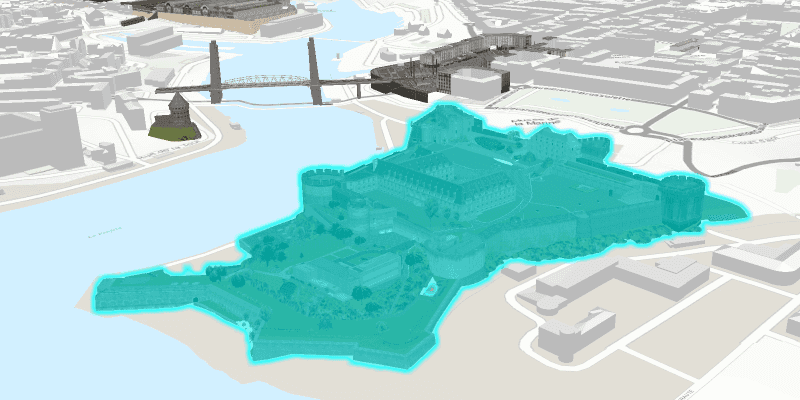
Click a building in the scene layer to select it. Deselect buildings by clicking away from the buildings.
How it works
- Create an
ArcGISSceneLayerpassing in the URL to a scene layer service. - Use
sceneView.setOnMouseClickedto get the screen click locationPoint2D. - Call
sceneView.identifyLayersAsync(sceneLayer, point2D, tolerance, false, 1)to identify features in the scene. - From the resulting
IdentifyLayerResult, get the list of identifiedGeoElements withresult.getElements(). - Get the first element in the list, checking that it is a feature, and call
sceneLayer.selectFeature(feature)to select it.
About the data
The scene shows a buildings layer in Brest, France hosted on ArcGIS Online.
Relevant API
- ArcGISSceneLayer
- Scene
- SceneView
Tags
3D, Berlin, buildings, identify, model, query, search, select
Sample Code
SceneLayerSelectionSample.java
/*
* Copyright 2018 Esri.
*
* Licensed under the Apache License, Version 2.0 (the "License"); you may not
* use this file except in compliance with the License. You may obtain a copy of
* the License at
*
* http://www.apache.org/licenses/LICENSE-2.0
*
* Unless required by applicable law or agreed to in writing, software
* distributed under the License is distributed on an "AS IS" BASIS, WITHOUT
* WARRANTIES OR CONDITIONS OF ANY KIND, either express or implied. See the
* License for the specific language governing permissions and limitations under
* the License.
*/
package com.esri.samples.scene_layer_selection;
import java.util.List;
import java.util.concurrent.ExecutionException;
import javafx.application.Application;
import javafx.geometry.Point2D;
import javafx.scene.Scene;
import javafx.scene.control.Alert;
import javafx.scene.input.MouseButton;
import javafx.scene.layout.StackPane;
import javafx.stage.Stage;
import com.esri.arcgisruntime.ArcGISRuntimeEnvironment;
import com.esri.arcgisruntime.concurrent.ListenableFuture;
import com.esri.arcgisruntime.data.Feature;
import com.esri.arcgisruntime.layers.ArcGISSceneLayer;
import com.esri.arcgisruntime.loadable.LoadStatus;
import com.esri.arcgisruntime.mapping.ArcGISScene;
import com.esri.arcgisruntime.mapping.ArcGISTiledElevationSource;
import com.esri.arcgisruntime.mapping.BasemapStyle;
import com.esri.arcgisruntime.mapping.GeoElement;
import com.esri.arcgisruntime.mapping.Surface;
import com.esri.arcgisruntime.mapping.view.Camera;
import com.esri.arcgisruntime.mapping.view.IdentifyLayerResult;
import com.esri.arcgisruntime.mapping.view.SceneView;
public class SceneLayerSelectionSample extends Application {
private SceneView sceneView;
@Override
public void start(Stage stage) {
try {
// create stack pane and JavaFX app scene
StackPane stackPane = new StackPane();
Scene fxScene = new Scene(stackPane);
// set title, size, and add JavaFX scene to stage
stage.setTitle("Scene Layer Selection Sample");
stage.setWidth(800);
stage.setHeight(700);
stage.setScene(fxScene);
stage.show();
// authentication with an API key or named user is required to access basemaps and other location services
String yourAPIKey = System.getProperty("apiKey");
ArcGISRuntimeEnvironment.setApiKey(yourAPIKey);
// create a scene with a basemap style
ArcGISScene scene = new ArcGISScene(BasemapStyle.ARCGIS_TOPOGRAPHIC);
// set the scene to the scene view
sceneView = new SceneView();
sceneView.setArcGISScene(scene);
// set the initial viewpoint
Camera camera = new Camera(48.378, -4.494, 200, 345, 65, 0);
sceneView.setViewpointCamera(camera);
// add the scene view to the stack pane
stackPane.getChildren().add(sceneView);
// add base surface with elevation data
Surface surface = new Surface();
final String elevationService = "https://elevation3d.arcgis.com/arcgis/rest/services/WorldElevation3D/Terrain3D/ImageServer";
surface.getElevationSources().add(new ArcGISTiledElevationSource(elevationService));
scene.setBaseSurface(surface);
// add a scene layer of buildings in Brest, France
final String buildings = "http://tiles.arcgis.com/tiles/P3ePLMYs2RVChkJx/arcgis/rest/services/Buildings_Brest/SceneServer/layers/0";
ArcGISSceneLayer sceneLayer = new ArcGISSceneLayer(buildings);
scene.getOperationalLayers().add(sceneLayer);
// zoom to the layer's extent when loaded
sceneLayer.addDoneLoadingListener(() -> {
if (sceneLayer.getLoadStatus() == LoadStatus.LOADED) {
// when the scene is clicked, identify the clicked feature and select it
sceneView.setOnMouseClicked(e -> {
if (e.isStillSincePress() && e.getButton() == MouseButton.PRIMARY) {
// clear any previous selection
sceneLayer.clearSelection();
// identify clicked feature
Point2D point2D = new Point2D(e.getX(), e.getY());
ListenableFuture<IdentifyLayerResult> identify = sceneView.identifyLayerAsync(sceneLayer, point2D, 10, false, 1);
identify.addDoneListener(() -> {
try {
// get the identified result and check that it is a feature
IdentifyLayerResult result = identify.get();
List<GeoElement> geoElements = result.getElements();
if (geoElements.size() > 0) {
GeoElement geoElement = geoElements.get(0);
if (geoElement instanceof Feature) {
// select the feature
sceneLayer.selectFeature((Feature) geoElement);
}
}
} catch (InterruptedException | ExecutionException ex) {
new Alert(Alert.AlertType.ERROR, "Error identifying features").show();
}
});
}
});
} else {
new Alert(Alert.AlertType.ERROR, "Error loading scene layer").show();
}
});
} catch (Exception e) {
// on any error, display the stack trace.
e.printStackTrace();
}
}
/**
* Stops and releases all resources used in application.
*/
@Override
public void stop() {
if (sceneView != null) {
sceneView.dispose();
}
}
/**
* Opens and runs application.
*
* @param args arguments passed to this application
*/
public static void main(String[] args) {
Application.launch(args);
}
}