Render features in a scene statically or dynamically by setting the feature layer rendering mode.
Use case
In dynamic rendering mode, features and graphics are stored on the GPU. As a result, dynamic rendering mode is good for moving objects and for maintaining graphical fidelity during extent changes, since individual graphic changes can be efficiently applied directly to the GPU state. This gives the map or scene a seamless look and feel when interacting with it. The number of features and graphics has a direct impact on GPU resources, so large numbers of features or graphics can affect the responsiveness of maps or scenes to user interaction. Ultimately, the number and complexity of features and graphics that can be rendered in dynamic rendering mode is dependent on the power and memory of the device’s GPU.
In static rendering mode, features and graphics are rendered only when needed (for example, after an extent change) and offloads a significant portion of the graphical processing onto the CPU. As a result, less work is required by the GPU to draw the graphics, and the GPU can spend its resources on keeping the UI interactive. Use this mode for stationary graphics, complex geometries, and very large numbers of features or graphics. The number of features and graphics has little impact on frame render time, meaning it scales well, and pushes a constant GPU payload. However, rendering updates is CPU and system memory intensive, which can have an impact on device battery life.
How to use the sample
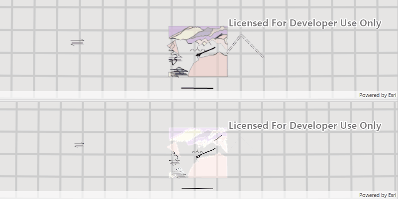
When opened, the sample will automatically perform the the same zoom animation on both static and dynamically rendered scenes.
How it works
- Create an
ArcGISSceneand callgetLoadSettings()and thensetPreferred[Point/Polyline/Polygon]FeatureRenderingMode(...). - The
RenderingModecan be set toSTATIC,DYNAMICorAUTOMATIC.- In Static rendering mode, the number of features and graphics has little impact on frame render time, meaning it scales well, however points don’t stay screen-aligned and point/polyline/polygon objects are only redrawn once map view navigation is complete.
- In Dynamic rendering mode, large numbers of features or graphics can affect the responsiveness of maps or scenes to user interaction, however points remain screen-aligned and point/polyline/polygon objects are continually redrawn while the map view is navigating.
- When left to automatic rendering, points are drawn dynamically and polylines and polygons statically.
Relevant API
- ArcGISScene
- FeatureLayer
- FeatureLayer.RenderingMode
- LoadSettings
- SceneView
Tags
3D, dynamic, feature layer, features, rendering, static
Sample Code
/* * Copyright 2022 Esri. * * Licensed under the Apache License, Version 2.0 (the "License"); * you may not use this file except in compliance with the License. * You may obtain a copy of the License at * * http://www.apache.org/licenses/LICENSE-2.0 * * Unless required by applicable law or agreed to in writing, software * distributed under the License is distributed on an "AS IS" BASIS, * WITHOUT WARRANTIES OR CONDITIONS OF ANY KIND, either express or implied. * See the License for the specific language governing permissions and * limitations under the License. */
module com.esri.samples.feature_layer_rendering_mode_scene {  // require ArcGIS Maps SDK for Java module  requires com.esri.arcgisruntime;
  // handle SLF4J http://www.slf4j.org/codes.html#StaticLoggerBinder  requires org.slf4j.nop;
  // require JavaFX modules that the application uses  requires javafx.graphics;
  exports com.esri.samples.feature_layer_rendering_mode_scene;}
/* * Copyright 2017 Esri. * * Licensed under the Apache License, Version 2.0 (the "License"); you may not * use this file except in compliance with the License. You may obtain a copy of * the License at * * http://www.apache.org/licenses/LICENSE-2.0 * * Unless required by applicable law or agreed to in writing, software * distributed under the License is distributed on an "AS IS" BASIS, WITHOUT * WARRANTIES OR CONDITIONS OF ANY KIND, either express or implied. See the * License for the specific language governing permissions and limitations under * the License. */
package com.esri.samples.feature_layer_rendering_mode_scene;
import java.util.Arrays;
import javafx.animation.Animation;import javafx.animation.KeyFrame;import javafx.animation.Timeline;import javafx.application.Application;import javafx.geometry.Orientation;import javafx.scene.Scene;import javafx.scene.control.SplitPane;import javafx.stage.Stage;import javafx.util.Duration;
import com.esri.arcgisruntime.data.ServiceFeatureTable;import com.esri.arcgisruntime.geometry.Point;import com.esri.arcgisruntime.geometry.SpatialReferences;import com.esri.arcgisruntime.layers.FeatureLayer;import com.esri.arcgisruntime.mapping.ArcGISScene;import com.esri.arcgisruntime.mapping.view.Camera;import com.esri.arcgisruntime.mapping.view.SceneView;
public class FeatureLayerRenderingModeSceneSample extends Application {
private SceneView sceneViewTop; private SceneView sceneViewBottom; private Timeline timeline;
@Override public void start(Stage stage) {
try {
// create splitPane pane and JavaFX app scene SplitPane splitPane = new SplitPane(); splitPane.setOrientation(Orientation.VERTICAL); Scene fxScene = new Scene(splitPane);
// set title, size, and add JavaFX scene to stage stage.setTitle("Feature Layer Rendering Mode Scene Sample"); stage.setWidth(800); stage.setHeight(700); stage.setScene(fxScene); stage.show();
// create a scene (top) and set it to render all features in static rendering mode ArcGISScene sceneTop = new ArcGISScene(); sceneTop.getLoadSettings().setPreferredPointFeatureRenderingMode(FeatureLayer.RenderingMode.STATIC); sceneTop.getLoadSettings().setPreferredPolylineFeatureRenderingMode(FeatureLayer.RenderingMode.STATIC); sceneTop.getLoadSettings().setPreferredPolygonFeatureRenderingMode(FeatureLayer.RenderingMode.STATIC);
// create a scene (bottom) and set it to render all features in dynamic rendering mode ArcGISScene sceneBottom = new ArcGISScene(); sceneBottom.getLoadSettings().setPreferredPointFeatureRenderingMode(FeatureLayer.RenderingMode.DYNAMIC); sceneBottom.getLoadSettings().setPreferredPolylineFeatureRenderingMode(FeatureLayer.RenderingMode.DYNAMIC); sceneBottom.getLoadSettings().setPreferredPolygonFeatureRenderingMode(FeatureLayer.RenderingMode.DYNAMIC);
// creating top scene view sceneViewTop = new SceneView(); sceneViewTop.setArcGISScene(sceneTop); splitPane.getItems().add(sceneViewTop); // creating bottom scene view sceneViewBottom = new SceneView(); sceneViewBottom.setArcGISScene(sceneBottom); splitPane.getItems().add(sceneViewBottom);
// create service feature table using a point, polyline, and polygon service ServiceFeatureTable pointServiceFeatureTable = new ServiceFeatureTable("https://sampleserver6.arcgisonline.com/arcgis/rest/services/Energy/Geology/FeatureServer/0"); ServiceFeatureTable polylineServiceFeatureTable = new ServiceFeatureTable("https://sampleserver6.arcgisonline.com/arcgis/rest/services/Energy/Geology/FeatureServer/8"); ServiceFeatureTable polygonServiceFeatureTable = new ServiceFeatureTable("https://sampleserver6.arcgisonline.com/arcgis/rest/services/Energy/Geology/FeatureServer/9");
// create feature layer from service feature tables FeatureLayer pointFeatureLayer = new FeatureLayer(pointServiceFeatureTable); FeatureLayer polylineFeatureLayer = new FeatureLayer(polylineServiceFeatureTable); FeatureLayer polygonFeatureLayer = new FeatureLayer(polygonServiceFeatureTable);
// add each layer to top and bottom scene sceneTop.getOperationalLayers().addAll(Arrays.asList(pointFeatureLayer, polylineFeatureLayer, polygonFeatureLayer)); sceneBottom.getOperationalLayers().addAll(Arrays.asList(pointFeatureLayer.copy(), polylineFeatureLayer.copy(), polygonFeatureLayer.copy()));
// camera locations for camera to zoom in and out to Camera zoomOutCamera = new Camera(new Point(-118.37, 34.46, SpatialReferences.getWgs84()), 42000, 0, 0, 0); Camera zoomInCamera = new Camera(new Point(-118.45, 34.395, SpatialReferences.getWgs84()), 2500, 90, 75, 0); sceneViewTop.setViewpointCamera(zoomOutCamera); sceneViewBottom.setViewpointCamera(zoomOutCamera);
//loop an animation into and out from the zoom in point (5 seconds each) with a 2 second gap between zooming timeline = new Timeline(); timeline.setCycleCount(Animation.INDEFINITE); timeline.getKeyFrames().add(new KeyFrame(Duration.seconds(7), event -> zoomTo(zoomOutCamera))); timeline.getKeyFrames().add(new KeyFrame(Duration.seconds(14), event -> zoomTo(zoomInCamera))); timeline.play();
} catch (Exception e) { // on any error, display the stack trace. e.printStackTrace(); } }
/** * Sets both SceneViews to a ViewpointCamera over a number of seconds. * @param camera to which both SceneViews should be set. * */ private void zoomTo(Camera camera) { sceneViewTop.setViewpointCameraAsync(camera, 5); sceneViewBottom.setViewpointCameraAsync(camera, 5); }
/** * Stops and releases all resources used in application. */ @Override public void stop() {
// stop the timer timeline.stop();
if (sceneViewTop != null) { sceneViewTop.dispose(); } if (sceneViewBottom != null) { sceneViewBottom.dispose(); } }
/** * Opens and runs application. * * @param args arguments passed to this application */ public static void main(String[] args) {
Application.launch(args); }
}