Filter data in layers by applying a time extent to a MapView.
Use case
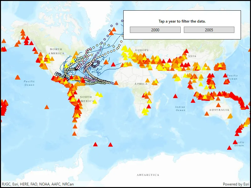
When viewing feature layers that contain a large amount of data with timestamps, you may want to filter the data to only show data relevant to a specific time frame. This can help to visualize changes in the data over time and aids in making better interpretations and predictions of future trends.
How to use the sample
Switch between the available options and observe how the data is filtered.
How it works
- Create a
MapViewwith aMap, and add layers that have time-enabled data. - Set the
TimeExtentof the map view usingTimeExtentproperty of the .
Relevant API
- Map
- MapView
- TimeExtent
Additional information
Note that time filtering is not applied until the MapView is provided with a TimeExtent. If the TimeExtent is null, no time filtering is applied and all content is rendered.
Tags
data, filter, time, time frame, time span
Sample code
// Copyright 2018 Esri.//// Licensed under the Apache License, Version 2.0 (the "License"); you may not use this file except in compliance with the License.// You may obtain a copy of the License at: http://www.apache.org/licenses/LICENSE-2.0//// Unless required by applicable law or agreed to in writing, software distributed under the License is distributed on an// "AS IS" BASIS, WITHOUT WARRANTIES OR CONDITIONS OF ANY KIND, either express or implied. See the License for the specific// language governing permissions and limitations under the License.
using Esri.ArcGISRuntime;using Esri.ArcGISRuntime.Mapping;using System;using System.Windows;
namespace ArcGIS.WPF.Samples.ChangeTimeExtent{    [ArcGIS.Samples.Shared.Attributes.Sample(        name: "Change time extent",        category: "MapView",        description: "Filter data in layers by applying a time extent to a MapView.",        instructions: "Switch between the available options and observe how the data is filtered.",        tags: new[] { "data", "filter", "time", "time frame", "time span" })]    public partial class ChangeTimeExtent    {        // Hold two map service URIs, one for use with an ArcGISMapImageLayer, the other for use with a FeatureLayer.        private readonly Uri _mapServerUri = new Uri("https://sampleserver6.arcgisonline.com/arcgis/rest/services/Hurricanes/MapServer");        private readonly Uri _featureLayerUri = new Uri("https://sampleserver6.arcgisonline.com/arcgis/rest/services/Earthquakes_Since1970/MapServer/0");
        public ChangeTimeExtent()        {            InitializeComponent();
            Initialize();        }
        private void Initialize()        {            // Create new Map with basemap and initial location.            Map map = new Map(BasemapStyle.ArcGISTopographic);
            // Assign the map to the MapView.            MyMapView.Map = map;
            // Load the layers from the corresponding URIs.            ArcGISMapImageLayer imageryLayer = new ArcGISMapImageLayer(_mapServerUri);            FeatureLayer pointLayer = new FeatureLayer(_featureLayerUri);
            // Add the layers to the map.            MyMapView.Map.OperationalLayers.Add(imageryLayer);            MyMapView.Map.OperationalLayers.Add(pointLayer);        }
        private void twoThousand_Click(object sender, RoutedEventArgs e)        {            // Hard-coded start value: January 1st, 2000.            DateTime start = new DateTime(2000, 1, 1);
            // Hard-coded end value: December 31st, 2000.            DateTime end = new DateTime(2000, 12, 31);
            // Set the time extent on the map with the hard-coded values.            MyMapView.TimeExtent = new TimeExtent(start, end);        }
        private void twoThousandFive_Click(object sender, RoutedEventArgs e)        {            // Hard-coded start value: January 1st, 2005.            DateTime start = new DateTime(2005, 1, 1);
            // Hard-coded end value: December 31st, 2005.            DateTime end = new DateTime(2005, 12, 31);
// Set the time extent on the map with the hard-coded values. MyMapView.TimeExtent = new TimeExtent(start, end); } }}<UserControl x:Class="ArcGIS.WPF.Samples.ChangeTimeExtent.ChangeTimeExtent" xmlns="http://schemas.microsoft.com/winfx/2006/xaml/presentation" xmlns:x="http://schemas.microsoft.com/winfx/2006/xaml" xmlns:esri="http://schemas.esri.com/arcgis/runtime/2013"> <Grid> <esri:MapView x:Name="MyMapView" /> <Border Style="{StaticResource BorderStyle}"> <Grid> <Grid.RowDefinitions> <RowDefinition /> <RowDefinition /> </Grid.RowDefinitions> <Grid.ColumnDefinitions> <ColumnDefinition Width="*" /> <ColumnDefinition Width="*" /> </Grid.ColumnDefinitions> <Label Grid.Row="0" Grid.Column="0" Grid.ColumnSpan="2" HorizontalAlignment="Center" Content="Tap a year to filter the data." FontWeight="SemiBold" /> <Button Grid.Row="1" Grid.Column="0" Margin="0,5,5,0" Click="twoThousand_Click" Content="2000" /> <Button Grid.Row="1" Grid.Column="1" Margin="5,5,0,0" Click="twoThousandFive_Click" Content="2005" /> </Grid> </Border> </Grid></UserControl>