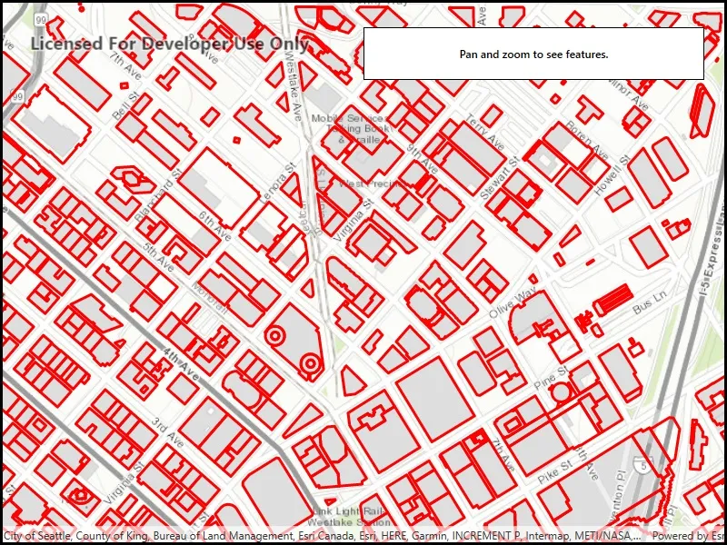
Display a layer from a WFS service, requesting only features for the current extent.
Use case
WFS is an open standard with functionality similar to ArcGIS feature services. Runtime support for WFS allows you to interoperate with open systems, which are often used in inter-agency efforts, like those for disaster relief.
How to use the sample
Pan and zoom to see features within the current map extent.
How it works
- Create a
WfsFeatureTablewith a URL. - Create a
FeatureLayerfrom the feature table and add it to the map. - Listen for the
MapView.NavigationCompletedevent to detect when the user has stopped navigating the map. - When the user is finished navigating, use
PopulateFromServiceAsyncto load the table with data for the current visible extent.
Relevant API
- FeatureLayer
- MapView.NavigationCompleted
- WfsFeatureTable
- WfsFeatureTable.PopulateFromServiceAsync
About the data
This service shows building footprints for downtown Seattle. For additional information, see the underlying service on ArcGIS Online.
Tags
browse, catalog, feature, interaction cache, layers, OGC, service, web, WFS
Sample code
// Copyright 2019 Esri.//// Licensed under the Apache License, Version 2.0 (the "License"); you may not use this file except in compliance with the License.// You may obtain a copy of the License at: http://www.apache.org/licenses/LICENSE-2.0//// Unless required by applicable law or agreed to in writing, software distributed under the License is distributed on an// "AS IS" BASIS, WITHOUT WARRANTIES OR CONDITIONS OF ANY KIND, either express or implied. See the License for the specific// language governing permissions and limitations under the License.
using Esri.ArcGISRuntime.Data;using Esri.ArcGISRuntime.Geometry;using Esri.ArcGISRuntime.Mapping;using Esri.ArcGISRuntime.Symbology;using System;using System.Diagnostics;using System.Threading.Tasks;using System.Windows;using Color = System.Drawing.Color;
namespace ArcGIS.WPF.Samples.DisplayWfs{    [ArcGIS.Samples.Shared.Attributes.Sample(        name: "Display WFS layer",        category: "Layers",        description: "Display a layer from a WFS service, requesting only features for the current extent.",        instructions: "Pan and zoom to see features within the current map extent.",        tags: new[] { "OGC", "WFS", "browse", "catalog", "feature", "interaction cache", "layers", "service", "web" })]    public partial class DisplayWfs    {        // Hold a reference to the WFS feature table.        private WfsFeatureTable _featureTable;
        // Constants for the service URL and layer name.        private const string ServiceUrl = "https://dservices2.arcgis.com/ZQgQTuoyBrtmoGdP/arcgis/services/Seattle_Downtown_Features/WFSServer?service=wfs&request=getcapabilities";
        // Note that the layer name is defined by the service. The layer name can be accessed via WfsLayerInfo.Name.        private const string LayerName = "Seattle_Downtown_Features:Buildings";
        public DisplayWfs()        {            InitializeComponent();            _ = Initialize();        }
        private async Task Initialize()        {            // Create the map with topographic basemap.            MyMapView.Map = new Map(BasemapStyle.ArcGISTopographic);
            try            {                // Create the feature table from URI and layer name.                _featureTable = new WfsFeatureTable(new Uri(ServiceUrl), LayerName);
                // Set the feature request mode to manual - only manual is supported at v100.5.                // In this mode, you must manually populate the table - panning and zooming won't request features automatically.                _featureTable.FeatureRequestMode = FeatureRequestMode.ManualCache;
                // Load the table.                await _featureTable.LoadAsync();
                // Create a feature layer to visualize the WFS features.                FeatureLayer wfsFeatureLayer = new FeatureLayer(_featureTable);
                // Apply a renderer.                wfsFeatureLayer.Renderer = new SimpleRenderer(new SimpleLineSymbol(SimpleLineSymbolStyle.Solid, Color.Red, 3));
                // Add the layer to the map.                MyMapView.Map.OperationalLayers.Add(wfsFeatureLayer);
                // Use the navigation completed event to populate the table with the features needed for the current extent.                MyMapView.NavigationCompleted += MapView_NavigationCompleted;
                // Zoom to a small area within the dataset by default.                MapPoint topLeft = new MapPoint(-122.341581, 47.617207, SpatialReferences.Wgs84);                MapPoint bottomRight = new MapPoint(-122.332662, 47.613758, SpatialReferences.Wgs84);                await MyMapView.SetViewpointGeometryAsync(new Envelope(topLeft, bottomRight));            }            catch (Exception e)            {                MessageBox.Show(e.ToString(), "Couldn't load sample.");                Debug.WriteLine(e);            }        }
        private async void MapView_NavigationCompleted(object sender, EventArgs e)        {            // Show the loading bar.            LoadingProgressbar.Visibility = Visibility.Visible;
            // Get the current extent.            Envelope currentExtent = MyMapView.VisibleArea.Extent;
            // Create a query based on the current visible extent.            QueryParameters visibleExtentQuery = new QueryParameters();            visibleExtentQuery.Geometry = currentExtent;            visibleExtentQuery.SpatialRelationship = SpatialRelationship.Intersects;
try { // Populate the table with the query, leaving existing table entries intact. // Setting outFields to null requests all features. await _featureTable.PopulateFromServiceAsync(visibleExtentQuery, false, null); } catch (Exception exception) { MessageBox.Show(exception.ToString(), "Couldn't populate table."); Debug.WriteLine(exception); } finally { // Hide the loading bar. LoadingProgressbar.Visibility = Visibility.Collapsed; } } }}<UserControl x:Class="ArcGIS.WPF.Samples.DisplayWfs.DisplayWfs" xmlns="http://schemas.microsoft.com/winfx/2006/xaml/presentation" xmlns:x="http://schemas.microsoft.com/winfx/2006/xaml" xmlns:esri="http://schemas.esri.com/arcgis/runtime/2013"> <Grid> <esri:MapView x:Name="MyMapView" /> <Border Style="{StaticResource BorderStyle}"> <StackPanel> <TextBlock FontWeight="SemiBold" Text="Pan and zoom to see features." TextAlignment="Center" /> <ProgressBar x:Name="LoadingProgressbar" IsEnabled="True" IsIndeterminate="True" Visibility="Collapsed" /> </StackPanel> </Border> </Grid></UserControl>