Geocode addresses to locations and reverse geocode locations to addresses offline.
Use case
You can use an address locator file to geocode addresses and locations. For example, you could provide offline geocoding capabilities to field workers repairing critical infrastructure in a disaster when network availability is limited.
How to use the sample
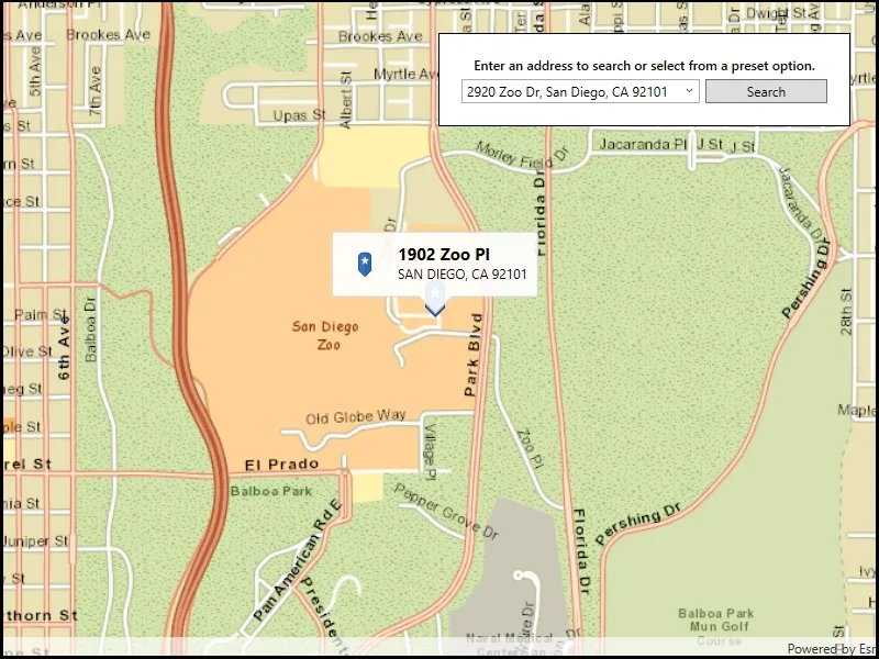
Type the address in the Search menu option or select from the list to Geocode the address and view the result on the map. Tap the location you want to reverse geocode. Tap the pin to see the full address.
How it works
- Use the path of a .loc file to create a
LocatorTaskobject. - Set up
GeocodeParametersand callGeocodeAsyncto get geocode results.
Relevant API
- GeocodeParameters
- GeocodeResult
- LocatorTask
- ReverseGeocodeParameters
Offline data
This sample downloads the following items from ArcGIS Online automatically:
- San Diego Streets Tile Package - Streets Tile Package (tpkx) for the City of San Diego.
- San Diego Offline Locator - Includes San Diego Locator Offline Dataset.
Tags
geocode, geocoder, locator, offline, package, query, search
Sample code
// Copyright 2019 Esri.//// Licensed under the Apache License, Version 2.0 (the "License"); you may not use this file except in compliance with the License.// You may obtain a copy of the License at: http://www.apache.org/licenses/LICENSE-2.0//// Unless required by applicable law or agreed to in writing, software distributed under the License is distributed on an// "AS IS" BASIS, WITHOUT WARRANTIES OR CONDITIONS OF ANY KIND, either express or implied. See the License for the specific// language governing permissions and limitations under the License.
using ArcGIS.Samples.Managers;using Esri.ArcGISRuntime.Geometry;using Esri.ArcGISRuntime.Mapping;using Esri.ArcGISRuntime.Symbology;using Esri.ArcGISRuntime.Tasks.Geocoding;using Esri.ArcGISRuntime.UI;using Esri.ArcGISRuntime.UI.Controls;using System;using System.Collections.Generic;using System.IO;using System.Linq;using System.Reflection;using System.Threading.Tasks;using System.Windows;using System.Windows.Controls;
namespace ArcGIS.WPF.Samples.OfflineGeocode{    [ArcGIS.Samples.Shared.Attributes.Sample(        name: "Offline geocode",        category: "Search",        description: "Geocode addresses to locations and reverse geocode locations to addresses offline.",        instructions: "Type the address in the Search menu option or select from the list to `Geocode` the address and view the result on the map. Tap the location you want to reverse geocode. Tap the pin to see the full address.",        tags: new[] { "geocode", "geocoder", "locator", "offline", "package", "query", "search" })]    [ArcGIS.Samples.Shared.Attributes.OfflineData("22c3083d4fa74e3e9b25adfc9f8c0496", "3424d442ebe54f3cbf34462382d3aebe")]    public partial class OfflineGeocode    {        // Addresses for suggestion.        private readonly string[] _addresses =        {            "910 N Harbor Dr, San Diego, CA 92101",            "2920 Zoo Dr, San Diego, CA 92101",            "111 W Harbor Dr, San Diego, CA 92101",            "868 4th Ave, San Diego, CA 92101",            "750 A St, San Diego, CA 92101"        };
        // The LocatorTask provides geocoding services.        private LocatorTask _geocoder;
        public OfflineGeocode()        {            InitializeComponent();
            // Setup the control references and execute initialization            _ = Initialize();        }
        private async Task Initialize()        {            // Get the offline tile package and use it as a basemap.            string basemapPath = DataManager.GetDataFolder("22c3083d4fa74e3e9b25adfc9f8c0496", "streetmap_SD.tpkx");            ArcGISTiledLayer tiledBasemapLayer = new ArcGISTiledLayer(new TileCache(basemapPath));
            // Create new Map with basemap.            Map myMap = new Map(new Basemap(tiledBasemapLayer));
            // Provide Map to the MapView.            MyMapView.Map = myMap;
            // Add a graphics overlay for showing pins.            MyMapView.GraphicsOverlays.Add(new GraphicsOverlay());
            // Enable tap-for-info pattern on results.            MyMapView.GeoViewTapped += MyMapView_GeoViewTapped;
            // Update suggestions.            SearchBox.ItemsSource = _addresses;
            // Initialize the LocatorTask with the provided service Uri.            try            {                // Get the path to the locator.                string locatorPath = DataManager.GetDataFolder("3424d442ebe54f3cbf34462382d3aebe", "SanDiego_StreetAddress.loc");
                // Load the geocoder.                _geocoder = await LocatorTask.CreateAsync(new Uri(locatorPath));
                // Enable UI controls now that the LocatorTask is ready.                SearchBox.IsEnabled = true;                SearchButton.IsEnabled = true;            }            catch (Exception e)            {                MessageBox.Show(e.ToString(), "Error");            }        }
        private async Task UpdateSearch()        {            // Get the text in the search bar.            string enteredText = SearchBox.Text;
            // Clear existing marker.            MyMapView.GraphicsOverlays[0].Graphics.Clear();            MyMapView.DismissCallout();
            // Return if the textbox is empty or the geocoder isn't ready.            if (string.IsNullOrWhiteSpace(enteredText) || _geocoder == null) return;
            try            {                // Get suggestions based on the input text.                IReadOnlyList<GeocodeResult> geocodeResults = await _geocoder.GeocodeAsync(enteredText);
                // Stop if there are no suggestions.                if (!geocodeResults.Any())                {                    MessageBox.Show("No results found");                    return;                }
                // Get the full address for the first suggestion.                GeocodeResult firstSuggestion = geocodeResults.First();                IReadOnlyList<GeocodeResult> addresses = await _geocoder.GeocodeAsync(firstSuggestion.Label);
                // Stop if the geocoder does not return a result.                if (addresses.Count < 1) return;
                // Show a graphic for the address.                Graphic point = await GraphicForPoint(addresses.First().DisplayLocation);                MyMapView.GraphicsOverlays[0].Graphics.Add(point);
                // Update the map extent to show the marker.                MyMapView.SetViewpoint(new Viewpoint(addresses.First().Extent));            }            catch (Exception e)            {                MessageBox.Show(e.ToString(), "Error");            }        }
        private async void MyMapView_GeoViewTapped(object sender, GeoViewInputEventArgs e)        {            try            {                // Clear existing callout and graphics.                MyMapView.DismissCallout();                MyMapView.GraphicsOverlays[0].Graphics.Clear();
                // Add a graphic for the tapped point.                Graphic pinGraphic = await GraphicForPoint(e.Location);                MyMapView.GraphicsOverlays[0].Graphics.Add(pinGraphic);
                // Reverse geocode to get addresses.                ReverseGeocodeParameters parameters = new ReverseGeocodeParameters();                parameters.ResultAttributeNames.Add("*");                parameters.MaxResults = 1;                IReadOnlyList<GeocodeResult> addresses = await _geocoder.ReverseGeocodeAsync(e.Location, parameters);
                // Skip if there are no results.                if (!addresses.Any())                {                    MessageBox.Show("No results found.", "No results");                    return;                }
                // Get the first result.                GeocodeResult address = addresses.First();
                // Use the address as the callout title.                string calloutTitle = address.Attributes["StAddr"].ToString();                string calloutDetail = address.Attributes["City"].ToString() + ", " + address.Attributes["RegionAbbr"] + " " + address.Attributes["Postal"];
                // Define the callout.                CalloutDefinition calloutBody = new CalloutDefinition(calloutTitle, calloutDetail);
                // Show the callout on the map at the tapped location.                MyMapView.ShowCalloutForGeoElement(pinGraphic, e.Position, calloutBody);            }            catch (Exception ex)            {                MessageBox.Show(ex.ToString(), "Error");            }        }
        private void OnSuggestionChosen(object sender, SelectionChangedEventArgs e)        {            // Return if the user is typing.            if (SearchBox.SelectedValue == null) return;
            // Update the search.            SearchBox.Text = SearchBox.SelectedValue.ToString();            _ = UpdateSearch();        }
        private void Search_Clicked(object sender, RoutedEventArgs e)        {            _ = UpdateSearch();        }
        private async Task<Graphic> GraphicForPoint(MapPoint point)        {            // Hold a reference to the picture marker symbol.            PictureMarkerSymbol pinSymbol;
            // Get current assembly that contains the image.            Assembly currentAssembly = Assembly.GetExecutingAssembly();
            // Get the resource name of the blue pin image.            string resourceStreamName = this.GetType().Assembly.GetManifestResourceNames().Single(str => str.EndsWith("pin_star_blue.png"));
            // Load the blue pin resource stream.            using (Stream resourceStream = this.GetType().Assembly.                       GetManifestResourceStream(resourceStreamName))            {                // Create new symbol using asynchronous factory method from stream.                pinSymbol = await PictureMarkerSymbol.CreateAsync(resourceStream);                pinSymbol.Width = 60;                pinSymbol.Height = 60;                // The image is a pin; offset the image so that the pinpoint                //     is on the point rather than the image's true center.                pinSymbol.LeaderOffsetX = 30;                pinSymbol.OffsetY = 14;            }
return new Graphic(point, pinSymbol); } }}<UserControl x:Class="ArcGIS.WPF.Samples.OfflineGeocode.OfflineGeocode" xmlns="http://schemas.microsoft.com/winfx/2006/xaml/presentation" xmlns:x="http://schemas.microsoft.com/winfx/2006/xaml" xmlns:esri="http://schemas.esri.com/arcgis/runtime/2013"> <Grid> <esri:MapView x:Name="MyMapView" /> <Border Style="{StaticResource BorderStyle}"> <Grid> <Grid.RowDefinitions> <RowDefinition /> <RowDefinition /> </Grid.RowDefinitions> <Grid.ColumnDefinitions> <ColumnDefinition Width="2*" /> <ColumnDefinition Width="*" /> </Grid.ColumnDefinitions> <TextBlock Grid.Row="0" Grid.Column="0" Grid.ColumnSpan="2" FontWeight="SemiBold" Text="Enter an address to search or select from a preset option." TextAlignment="Center" /> <ComboBox x:Name="SearchBox" Grid.Row="1" Grid.Column="0" Margin="0,5,5,0" IsEditable="True" IsEnabled="False" ItemsSource="{Binding Suggestions}" SelectionChanged="OnSuggestionChosen" /> <Button x:Name="SearchButton" Grid.Row="1" Grid.Column="1" Margin="0,5,0,0" Click="Search_Clicked" Content="Search" IsEnabled="False" /> </Grid> </Border> </Grid></UserControl>