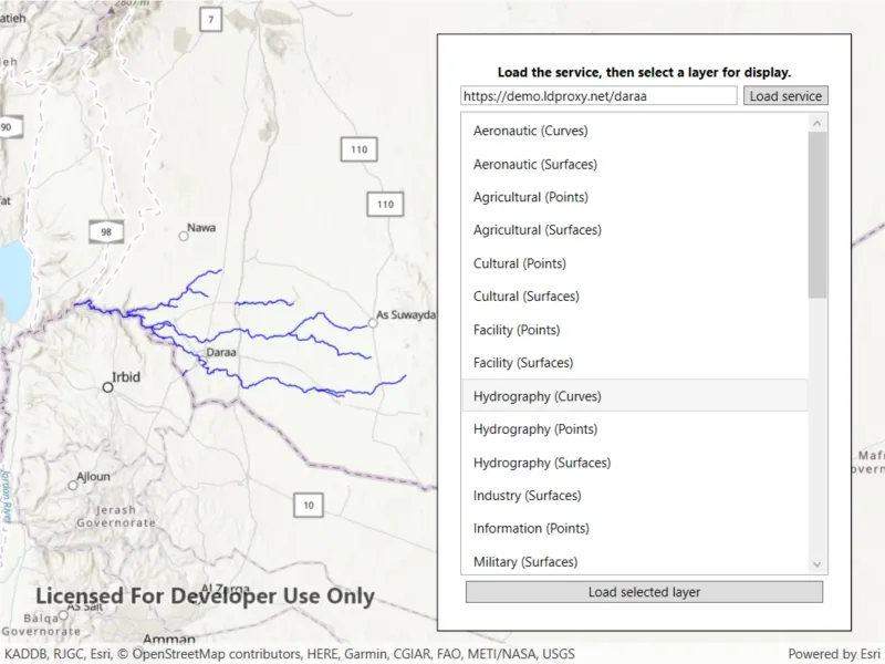
Browse an OGC API feature service for layers and add them to the map.
Use case
OGC API standards are used for sharing geospatial data on the web. As an open standard, the OGC API aims to improve access to geospatial or location information and could be a good choice for sharing data internationally or between organizations. That data could be of any type, including, for example transportation layers shared between government organizations and private businesses.
How to use the sample
Select a layer to display from the list of layers shown in an OGC API service.
How it works
- Create an
OgcFeatureServiceobject with a URL to an OGC API feature service. - Obtain the
OgcFeatureServiceInfofromOgcFeatureService.ServiceInfo. - Create a list of feature collections from the
OgcFeatureServiceInfo.FeatureCollectionInfos - When a feature collection is selected, create an
OgcFeatureCollectionTablefrom theOgcFeatureCollectionInfo. - Populate the
OgcFeatureCollectionTableusingPopulateFromServiceAsyncwithQueryParametersthat contain aMaxFeaturesproperty. - Create a feature layer from the feature table.
- Add the feature layer to the map.
Relevant API
- OgcFeatureCollectionInfo
- OgcFeatureCollectionTable
- OgcFeatureService
- OgcFeatureServiceInfo
About the data
The Daraa, Syria test data is OpenStreetMap data converted to the Topographic Data Store schema of NGA.
Additional information
See the OGC API website for more information on the OGC API family of standards.
Tags
browse, catalog, feature, layers, OGC, OGC API, service, web
Sample code
// Copyright 2021 Esri.//// Licensed under the Apache License, Version 2.0 (the "License"); you may not use this file except in compliance with the License.// You may obtain a copy of the License at: http://www.apache.org/licenses/LICENSE-2.0//// Unless required by applicable law or agreed to in writing, software distributed under the License is distributed on an// "AS IS" BASIS, WITHOUT WARRANTIES OR CONDITIONS OF ANY KIND, either express or implied. See the License for the specific// language governing permissions and limitations under the License.
using Esri.ArcGISRuntime.Data;using Esri.ArcGISRuntime.Geometry;using Esri.ArcGISRuntime.Mapping;using Esri.ArcGISRuntime.Ogc;using Esri.ArcGISRuntime.Symbology;using System;using System.Collections.Generic;using System.Diagnostics;using System.Threading.Tasks;using System.Windows;using Color = System.Drawing.Color;
namespace ArcGIS.WPF.Samples.BrowseOAFeatureService{    [ArcGIS.Samples.Shared.Attributes.Sample(        name: "Browse OGC API feature service",        category: "Layers",        description: "Browse an OGC API feature service for layers and add them to the map.",        instructions: "Select a layer to display from the list of layers shown in an OGC API service.",        tags: new[] { "OGC", "OGC API", "browse", "catalog", "feature", "layers", "service", "web" })]    public partial class BrowseOAFeatureService    {        // URL for the OGC feature service.        private const string ServiceUrl = "https://demo.ldproxy.net/daraa";
        public BrowseOAFeatureService()        {            InitializeComponent();            Initialize();        }
        private void Initialize()        {            // Init the UI.            ServiceTextBox.Text = ServiceUrl;
            // Create the map with topographic basemap.            MyMapView.Map = new Map(BasemapStyle.ArcGISTopographic);            _ = LoadService();        }
        private async Task LoadService()        {            try            {                LoadingProgressBar.Visibility = Visibility.Visible;                LoadLayersButton.IsEnabled = false;                LoadServiceButton.IsEnabled = false;
                // Create the OGC API - Features service using the landing URL.                OgcFeatureService service = new OgcFeatureService(new Uri(ServiceTextBox.Text));
                // Load the service.                await service.LoadAsync();
                // Get the service metadata.                OgcFeatureServiceInfo serviceInfo = service.ServiceInfo;
                // Get a list of available collections.                IEnumerable<OgcFeatureCollectionInfo> layerListReversed = serviceInfo.FeatureCollectionInfos;
                // Show the layers in the UI.                OgcFeatureCollectionList.ItemsSource = layerListReversed;            }            catch (Exception ex)            {                Debug.WriteLine(ex);                MessageBox.Show(ex.Message, "Error loading service");            }            finally            {                // Update the UI.                LoadingProgressBar.Visibility = Visibility.Collapsed;                LoadLayersButton.IsEnabled = true;                LoadServiceButton.IsEnabled = true;            }        }
        private async void LoadLayers_Clicked(object sender, RoutedEventArgs e)        {            // Skip if nothing selected.            if (OgcFeatureCollectionList.SelectedItems.Count < 1)            {                return;            }
            // Show the progress bar.            LoadingProgressBar.Visibility = Visibility.Visible;
            // Clear the existing layers.            MyMapView.Map.OperationalLayers.Clear();
            try            {                // Get the selected collection.                OgcFeatureCollectionInfo selectedCollectionInfo = (OgcFeatureCollectionInfo)OgcFeatureCollectionList.SelectedItems[0];
                // Create the OGC feature collection table.                OgcFeatureCollectionTable table = new OgcFeatureCollectionTable(selectedCollectionInfo);
                // Set the feature request mode to manual (only manual is currently supported).                // In this mode, you must manually populate the table - panning and zooming won't request features automatically.                table.FeatureRequestMode = FeatureRequestMode.ManualCache;
                // Populate the OGC feature collection table.                QueryParameters queryParamaters = new QueryParameters();                queryParamaters.MaxFeatures = 1000;                await table.PopulateFromServiceAsync(queryParamaters, false, null);
                // Create a feature layer from the OGC feature collection table.                FeatureLayer ogcFeatureLayer = new FeatureLayer(table);
                // Choose a renderer for the layer based on the table.                ogcFeatureLayer.Renderer = GetRendererForTable(table) ?? ogcFeatureLayer.Renderer;
                // Add the layer to the map.                MyMapView.Map.OperationalLayers.Add(ogcFeatureLayer);
                // Zoom to the extent of the selected collection.                if (selectedCollectionInfo.Extent is Envelope collectionExtent && !collectionExtent.IsEmpty)                {                    await MyMapView.SetViewpointGeometryAsync(collectionExtent, 100);                }            }            catch (Exception ex)            {                Debug.WriteLine(ex);                MessageBox.Show(ex.Message, "Error loading service");            }            finally            {                // Hide the progress bar.                LoadingProgressBar.Visibility = Visibility.Collapsed;            }        }
        private Renderer GetRendererForTable(FeatureTable table)        {            switch (table.GeometryType)            {                case GeometryType.Point:                case GeometryType.Multipoint:                    return new SimpleRenderer(new SimpleMarkerSymbol(SimpleMarkerSymbolStyle.Circle, Color.Blue, 5));
                case GeometryType.Polygon:                case GeometryType.Envelope:                    return new SimpleRenderer(new SimpleFillSymbol(SimpleFillSymbolStyle.Solid, Color.Blue, null));
                case GeometryType.Polyline:                    return new SimpleRenderer(new SimpleLineSymbol(SimpleLineSymbolStyle.Solid, Color.Blue, 1));            }
            return null;        }
private void LoadServiceButton_Click(object sender, RoutedEventArgs e) { _ = LoadService(); } }}<UserControl x:Class="ArcGIS.WPF.Samples.BrowseOAFeatureService.BrowseOAFeatureService" xmlns="http://schemas.microsoft.com/winfx/2006/xaml/presentation" xmlns:x="http://schemas.microsoft.com/winfx/2006/xaml" xmlns:esri="http://schemas.esri.com/arcgis/runtime/2013"> <Grid> <esri:MapView x:Name="MyMapView" /> <Border Style="{StaticResource BorderStyle}"> <Grid> <Grid.RowDefinitions> <RowDefinition Height="Auto" /> <RowDefinition Height="Auto" /> <RowDefinition Height="Auto" /> <RowDefinition Height="*" /> <RowDefinition Height="Auto" /> <RowDefinition Height="Auto" /> </Grid.RowDefinitions> <Grid.ColumnDefinitions> <ColumnDefinition Width="*" /> <ColumnDefinition Width="Auto" /> </Grid.ColumnDefinitions> <TextBlock Grid.Row="0" Grid.ColumnSpan="2" Margin="5" FontWeight="Bold" Foreground="Black" Text="Load the service, then select a layer for display." TextAlignment="Center" /> <TextBox x:Name="ServiceTextBox" Grid.Row="1" Grid.Column="0" Margin="0,0,5,5" /> <Button x:Name="LoadServiceButton" Grid.Row="1" Grid.Column="1" Margin="0,0,0,5" Padding="5,0,5,0" Click="LoadServiceButton_Click" Content="Load service" /> <ProgressBar x:Name="LoadingProgressBar" Grid.Row="2" Grid.ColumnSpan="2" Height="15" Margin="0,5,0,5" IsEnabled="True" IsIndeterminate="True" Visibility="Visible" /> <ListView x:Name="OgcFeatureCollectionList" Grid.Row="3" Grid.ColumnSpan="2" DisplayMemberPath="Title" SelectionMode="Single" /> <Button x:Name="LoadLayersButton" Grid.Row="5" Grid.ColumnSpan="2" Margin="0,5,0,5" Click="LoadLayers_Clicked" Content="Load selected layer" /> </Grid> </Border> </Grid></UserControl>