Select features in a feature layer.
Use case
Selecting features, whether by query or identify, can be an important step both in editing data and visualizing results. One possible use case would be to query a feature layer containing street furniture. A query might look for type “bench” and return a list of bench features contained in the features with an attribute of type bench. These might be selected for further editing (see FeatureQueryResult) or may just be highlighted visually.
How to use the sample
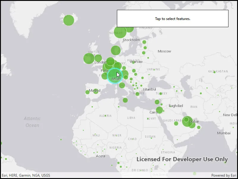
Click on a feature in the map. All features within a given tolerance (in pixels) of the click will be selected.
How it works
- Create a
ServiceFeatureTablefrom a feature service URL. - Create a
FeatureLayerfrom the service feature table. - Identify nearby features at the clicked location using
IdentifyLayerAsync(featureLayer, clickLocation, tolerance, returnPopupsOnly, maxResults)on the map view. - Select all identified features in the feature layer with
SelectFeatures(features).
Relevant API
- Feature
- FeatureLayer
- ServiceFeatureTable
About the data
This sample uses the Gross Domestic Product, 1960-2016 feature service. Only the 2016 GDP values are shown.
Tags
features, layers, select, selection, tolerance
Sample code
// Copyright 2016 Esri.//// Licensed under the Apache License, Version 2.0 (the "License"); you may not use this file except in compliance with the License.// You may obtain a copy of the License at: http://www.apache.org/licenses/LICENSE-2.0//// Unless required by applicable law or agreed to in writing, software distributed under the License is distributed on an// "AS IS" BASIS, WITHOUT WARRANTIES OR CONDITIONS OF ANY KIND, either express or implied. See the License for the specific// language governing permissions and limitations under the License.
using Esri.ArcGISRuntime;using Esri.ArcGISRuntime.Data;using Esri.ArcGISRuntime.Geometry;using Esri.ArcGISRuntime.Mapping;using Esri.ArcGISRuntime.UI.Controls;using System;using System.Drawing;using System.Threading.Tasks;using System.Windows;
namespace ArcGIS.WPF.Samples.FeatureLayerSelection{    [ArcGIS.Samples.Shared.Attributes.Sample(        name: "Feature layer selection",        category: "Layers",        description: "Select features in a feature layer.",        instructions: "Click on a feature in the map. All features within a given tolerance (in pixels) of the click will be selected.",        tags: new[] { "features", "layers", "select", "selection", "tolerance" })]    public partial class FeatureLayerSelection    {        // Hold a reference to the feature layer.        private FeatureLayer _featureLayer;
        public FeatureLayerSelection()        {            InitializeComponent();            _ = Initialize();        }
        private async Task Initialize()        {            // Create new Map with basemap.            Map myMap = new Map(BasemapStyle.ArcGISLightGray);
            // Create envelope to be used as a target extent for map's initial viewpoint.            Envelope myEnvelope = new Envelope(-6603299.491810, 1679677.742046, 9002253.947487, 8691318.054732, SpatialReferences.WebMercator);
            // Set the initial viewpoint for map.            myMap.InitialViewpoint = new Viewpoint(myEnvelope);
            // Provide used Map to the MapView.            MyMapView.Map = myMap;
            // Set the selection color.            MyMapView.SelectionProperties.Color = Color.Cyan;
            // Create Uri for the feature service.            Uri featureServiceUri = new Uri(                "https://services1.arcgis.com/4yjifSiIG17X0gW4/arcgis/rest/services/GDP_per_capita_1960_2016/FeatureServer/0");
            // Initialize feature table using a URL to feature server.            ServiceFeatureTable featureTable = new ServiceFeatureTable(featureServiceUri);
            // Initialize a new feature layer based on the feature table.            _featureLayer = new FeatureLayer(featureTable);
            try            {                // Make sure that used feature layer is loaded before hooking into the tapped event                // This prevents trying to do selection on the layer that isn't initialized.                await _featureLayer.LoadAsync();
                // Check for the load status. If the layer is loaded then add it to map.                if (_featureLayer.LoadStatus == LoadStatus.Loaded)                {                    // Add the feature layer to the map.                    myMap.OperationalLayers.Add(_featureLayer);
                    // Add tap event handler for mapview.                    MyMapView.GeoViewTapped += OnMapViewTapped;                }            }            catch (Exception e)            {                MessageBox.Show(e.ToString(), "Error");            }        }
        private async void OnMapViewTapped(object sender, GeoViewInputEventArgs e)        {            try            {                // Define the selection tolerance.                double tolerance = 15;
                // Convert the tolerance to map units.                double mapTolerance = tolerance * MyMapView.UnitsPerPixel;
                // Get the tapped point.                MapPoint geometry = e.Location;
                // Normalize the geometry if wrap-around is enabled.                //    This is necessary because of how wrapped-around map coordinates are handled by Runtime.                //    Without this step, querying may fail because wrapped-around coordinates are out of bounds.                if (MyMapView.IsWrapAroundEnabled)                {                    geometry = (MapPoint)geometry.NormalizeCentralMeridian();                }
                // Define the envelope around the tap location for selecting features.                Envelope selectionEnvelope = new Envelope(geometry.X - mapTolerance, geometry.Y - mapTolerance, geometry.X + mapTolerance,                    geometry.Y + mapTolerance, MyMapView.Map.SpatialReference);
                // Define the query parameters for selecting features.                QueryParameters queryParams = new QueryParameters                {                    // Set the geometry to selection envelope for selection by geometry.                    Geometry = selectionEnvelope                };
// Select the features based on query parameters defined above. await _featureLayer.SelectFeaturesAsync(queryParams, SelectionMode.New); } catch (Exception ex) { MessageBox.Show(ex.ToString(), "Error"); } } }}<UserControl x:Class="ArcGIS.WPF.Samples.FeatureLayerSelection.FeatureLayerSelection" xmlns="http://schemas.microsoft.com/winfx/2006/xaml/presentation" xmlns:x="http://schemas.microsoft.com/winfx/2006/xaml" xmlns:esri="http://schemas.esri.com/arcgis/runtime/2013"> <Grid> <esri:MapView x:Name="MyMapView" /> <Border Style="{StaticResource BorderStyle}"> <TextBlock FontWeight="SemiBold" Text="Tap to select features." TextAlignment="Center" /> </Border> </Grid></UserControl>