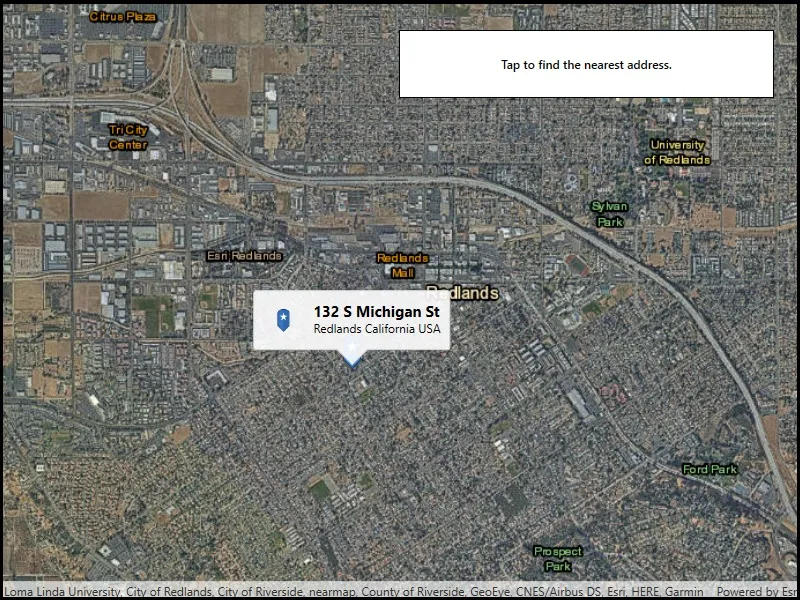
Use an online service to find the address for a tapped point.
Use case
You might use a geocoder to find a customer’s delivery address based on the location returned by their device’s GPS.
How to use the sample
Tap the map to see the nearest address displayed in a callout.
How it works
- Create a
LocatorTaskobject using a URL to a geocoder service. - Set the
GeocodeParametersfor theLocatorTaskand specify the geocoder’s attributes. - Get the matching results from the
GeocodeResultusingLocatorTask.reverseGeocodeAsync. - Show the results using a
PictureMarkerSymboland add the symbol to aGraphicin theGraphicsOverlay.
Relevant API
- GeocodeParameters
- LocatorTask
- ReverseGeocodeParameters
Additional information
This sample uses the World Geocoding Service. For more information, see the Geocoding service help topic on the ArcGIS Developer website.
Tags
address, geocode, locate, reverse geocode, search
Sample code
// Copyright 2019 Esri.//// Licensed under the Apache License, Version 2.0 (the "License"); you may not use this file except in compliance with the License.// You may obtain a copy of the License at: http://www.apache.org/licenses/LICENSE-2.0//// Unless required by applicable law or agreed to in writing, software distributed under the License is distributed on an// "AS IS" BASIS, WITHOUT WARRANTIES OR CONDITIONS OF ANY KIND, either express or implied. See the License for the specific// language governing permissions and limitations under the License.
using Esri.ArcGISRuntime.Geometry;using Esri.ArcGISRuntime.Mapping;using Esri.ArcGISRuntime.Symbology;using Esri.ArcGISRuntime.Tasks.Geocoding;using Esri.ArcGISRuntime.UI;using Esri.ArcGISRuntime.UI.Controls;using System;using System.Collections.Generic;using System.Diagnostics;using System.IO;using System.Linq;using System.Reflection;using System.Threading.Tasks;using System.Windows;
namespace ArcGIS.WPF.Samples.ReverseGeocode{    [ArcGIS.Samples.Shared.Attributes.Sample(        name: "Reverse geocode",        category: "Search",        description: "Use an online service to find the address for a tapped point.",        instructions: "Tap the map to see the nearest address displayed in a callout.",        tags: new[] { "address", "geocode", "locate", "reverse geocode", "search" })]    public partial class ReverseGeocode    {        // Service Uri to be provided to the LocatorTask (geocoder).        private readonly Uri _serviceUri = new Uri("https://geocode-api.arcgis.com/arcgis/rest/services/World/GeocodeServer");
        // The LocatorTask provides geocoding services.        private LocatorTask _geocoder;
        public ReverseGeocode()        {            InitializeComponent();            _ = Initialize();        }
        private async Task Initialize()        {            // Create new Map with basemap.            Map myMap = new Map(BasemapStyle.ArcGISImagery);
            // Provide used Map to the MapView.            MyMapView.Map = myMap;
            // Add a graphics overlay to the map for showing where the user tapped.            MyMapView.GraphicsOverlays.Add(new GraphicsOverlay());
            // Enable tap-for-info pattern on results.            MyMapView.GeoViewTapped += MyMapView_GeoViewTapped;
            // Initialize the LocatorTask with the provided service Uri.            try            {                _geocoder = await LocatorTask.CreateAsync(_serviceUri);            }            catch (Exception e)            {                MessageBox.Show(e.ToString(), "Error");            }
            // Set the initial viewpoint.            await MyMapView.SetViewpointCenterAsync(34.058, -117.195, 5e4);        }
        private async void MyMapView_GeoViewTapped(object sender, GeoViewInputEventArgs e)        {            try            {                // Clear the existing graphics & callouts.                MyMapView.DismissCallout();                MyMapView.GraphicsOverlays[0].Graphics.Clear();
                // Add a graphic for the tapped point.                Graphic pinGraphic = await GraphicForPoint(e.Location);                MyMapView.GraphicsOverlays[0].Graphics.Add(pinGraphic);
                // Normalize the geometry - needed if the user crosses the international date line.                MapPoint normalizedPoint = (MapPoint)e.Location.NormalizeCentralMeridian();
                // Reverse geocode to get addresses.                IReadOnlyList<GeocodeResult> addresses = await _geocoder.ReverseGeocodeAsync(normalizedPoint);
                // Get the first result.                GeocodeResult address = addresses.First();
                // Use the city and region for the Callout Title.                string calloutTitle = address.Attributes["Address"].ToString();
                // Use the metro area for the Callout Detail.                string calloutDetail = address.Attributes["City"] +                                       " " + address.Attributes["Region"] +                                       " " + address.Attributes["CountryCode"];
                // Define the callout.                CalloutDefinition calloutBody = new CalloutDefinition(calloutTitle, calloutDetail);
                // Show the callout on the map at the tapped location.                MyMapView.ShowCalloutForGeoElement(pinGraphic, e.Position, calloutBody);            }            catch (Exception ex)            {                Debug.WriteLine(ex);                MessageBox.Show("No results found.", "No results");            }        }
        private async Task<Graphic> GraphicForPoint(MapPoint point)        {            // Hold a reference to the picture marker symbol.            PictureMarkerSymbol pinSymbol;
            // Get current assembly that contains the image.            Assembly currentAssembly = Assembly.GetExecutingAssembly();
            // Get the resource name of the blue pin image.            string resourceStreamName = this.GetType().Assembly.GetManifestResourceNames().Single(str => str.EndsWith("pin_star_blue.png"));
            // Load the blue pin resource stream.            using (Stream resourceStream = this.GetType().Assembly.                       GetManifestResourceStream(resourceStreamName))            {                // Create new symbol using asynchronous factory method from stream.                pinSymbol = await PictureMarkerSymbol.CreateAsync(resourceStream);                pinSymbol.Width = 60;                pinSymbol.Height = 60;                // The image is a pin; offset the image so that the pinpoint                //     is on the point rather than the image's true center.                pinSymbol.LeaderOffsetX = 30;                pinSymbol.OffsetY = 14;            }
return new Graphic(point, pinSymbol); } }}<UserControl x:Class="ArcGIS.WPF.Samples.ReverseGeocode.ReverseGeocode" xmlns="http://schemas.microsoft.com/winfx/2006/xaml/presentation" xmlns:x="http://schemas.microsoft.com/winfx/2006/xaml" xmlns:esri="http://schemas.esri.com/arcgis/runtime/2013"> <Grid> <esri:MapView x:Name="MyMapView" /> <Border Style="{StaticResource BorderStyle}"> <Label HorizontalAlignment="Center" Content="Tap to find the nearest address." FontWeight="SemiBold" /> </Border> </Grid></UserControl>