Vertically exaggerate terrain in a scene.
Use case
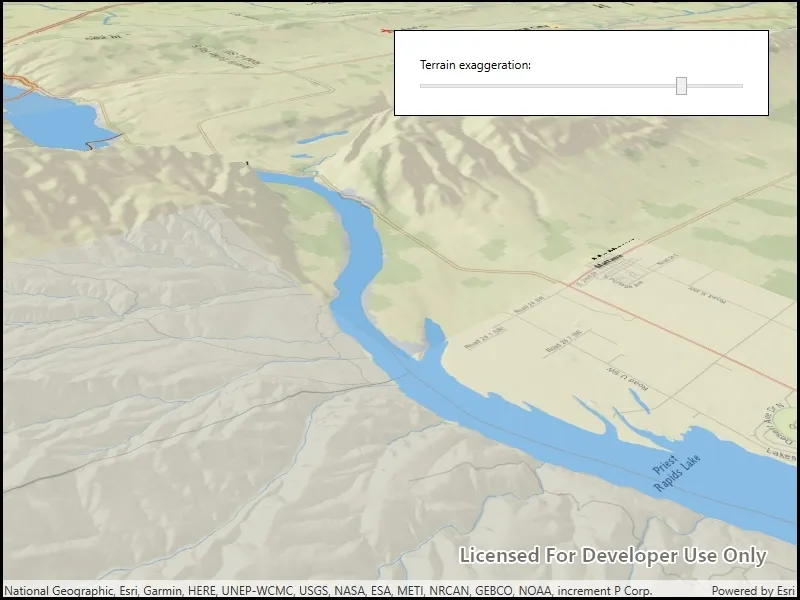
Vertical exaggeration can be used to emphasize subtle changes in a surface. This can be useful in creating visualizations of terrain where the horizontal extent of the surface is significantly greater than the amount of vertical change in the surface. A fractional vertical exaggeration can be used to flatten surfaces or features that have extreme vertical variation.
How to use the sample
Use the slider to update terrain exaggeration.
How it works
- Create an elevation source and add it to a new surface.
- An elevation source defines the terrain based on a digital elevation model (DEM) or digital terrain model (DTM).
- Add the surface.
- The surface visualizes the elevation source.
- Configure the surface’s elevation exaggeration using
Surface.ElevationExaggeration.
Relevant API
- Scene
- Scene.BaseSurface
- Surface
- Surface.ElevationExaggeration
Tags
3D, DEM, DTM, elevation, scene, surface, terrain
Sample code
// Copyright 2019 Esri.//// Licensed under the Apache License, Version 2.0 (the "License"); you may not use this file except in compliance with the License.// You may obtain a copy of the License at: http://www.apache.org/licenses/LICENSE-2.0//// Unless required by applicable law or agreed to in writing, software distributed under the License is distributed on an// "AS IS" BASIS, WITHOUT WARRANTIES OR CONDITIONS OF ANY KIND, either express or implied. See the License for the specific// language governing permissions and limitations under the License.
using Esri.ArcGISRuntime.Geometry;using Esri.ArcGISRuntime.Mapping;using System;
namespace ArcGIS.WPF.Samples.TerrainExaggeration{    [ArcGIS.Samples.Shared.Attributes.Sample(        name: "Terrain exaggeration",        category: "Scene",        description: "Vertically exaggerate terrain in a scene.",        instructions: "Use the slider to update terrain exaggeration.",        tags: new[] { "3D", "DEM", "DTM", "elevation", "scene", "surface", "terrain" })]    public partial class TerrainExaggeration    {        private readonly string _elevationServiceUrl = "https://elevation3d.arcgis.com/arcgis/rest/services/WorldElevation3D/Terrain3D/ImageServer";
        public TerrainExaggeration()        {            InitializeComponent();            Initialize();        }
        private void Initialize()        {            // Configure the scene with National Geographic basemap.            MySceneView.Scene = new Scene(BasemapStyle.ArcGISTopographic);
            // Add the base surface for elevation data.            Surface elevationSurface = new Surface();            ArcGISTiledElevationSource elevationSource = new ArcGISTiledElevationSource(new Uri(_elevationServiceUrl));            elevationSurface.ElevationSources.Add(elevationSource);
            // Add the surface to the scene.            MySceneView.Scene.BaseSurface = elevationSurface;
            // Set the initial camera.            MapPoint initialLocation = new MapPoint(-119.9489, 46.7592, 0, SpatialReferences.Wgs84);            Camera initialCamera = new Camera(initialLocation, 15000, 40, 60, 0);            MySceneView.SetViewpointCamera(initialCamera);
// Update terrain exaggeration based on the slider value. TerrainSlider.ValueChanged += (sender, e) => { elevationSurface.ElevationExaggeration = TerrainSlider.Value; }; } }}<UserControl x:Class="ArcGIS.WPF.Samples.TerrainExaggeration.TerrainExaggeration" xmlns="http://schemas.microsoft.com/winfx/2006/xaml/presentation" xmlns:x="http://schemas.microsoft.com/winfx/2006/xaml" xmlns:esri="http://schemas.esri.com/arcgis/runtime/2013"> <Grid> <esri:SceneView x:Name="MySceneView" /> <Border Style="{StaticResource BorderStyle}"> <StackPanel> <Label Content="Terrain exaggeration:" /> <Slider x:Name="TerrainSlider" AutoToolTipPlacement="TopLeft" AutoToolTipPrecision="2" Maximum="3" Minimum="1" Value="1" /> </StackPanel> </Border> </Grid></UserControl>