Create a feature collection layer to show a query result from a service feature table.
Use case
Consider a national wireless telecommunications company who wants to improve connectivity within areas of poor coverage. Their cell towers, cell tower radii and state boundaries data are held within service feature tables, which can be queried for states that don’t meet a certain threshold of coverage. The query result can be used to create and display a single feature collection layer for analysis of areas requiring improved coverage.
How to use the sample
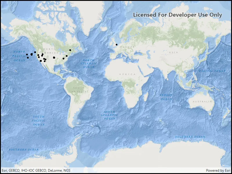
When launched, this sample displays a map with point features as a feature collection layer. Pan and zoom to explore the map.
How it works
- Perform a query using the
QueryFeaturesAsync()method on aServiceFeatureTable. - Instantiate a
FeatureCollectionTablewith the result of the query. - Create a
FeatureCollectionand add the feature collection table to it. - Create a
FeatureCollectionLayerfrom the feature collection. - Add the feature collection layer to the map’s
OperationalLayerslist.
Relevant API
- FeatureCollection
- FeatureCollectionLayer
- FeatureCollectionTable
- FeatureLayer
- FeatureQueryResult
- FeatureTable
- QueryParameters
- ServiceFeatureTable
About the data
This application utilizes data from the wildfire feature service. It loads at full extent with features indicating wildfire response point features across the world.
Tags
layer, query, search, table
Sample code
// Copyright 2016 Esri.//// Licensed under the Apache License, Version 2.0 (the "License"); you may not use this file except in compliance with the License.// You may obtain a copy of the License at: http://www.apache.org/licenses/LICENSE-2.0//// Unless required by applicable law or agreed to in writing, software distributed under the License is distributed on an// "AS IS" BASIS, WITHOUT WARRANTIES OR CONDITIONS OF ANY KIND, either express or implied. See the License for the specific// language governing permissions and limitations under the License.
using Esri.ArcGISRuntime.Data;using Esri.ArcGISRuntime.Mapping;using System;using System.Threading.Tasks;using System.Windows;
namespace ArcGIS.WPF.Samples.FeatureCollectionLayerFromQuery{    [ArcGIS.Samples.Shared.Attributes.Sample(        name: "Feature collection layer (query)",        category: "Layers",        description: "Create a feature collection layer to show a query result from a service feature table.",        instructions: "When launched, this sample displays a map with point features as a feature collection layer. Pan and zoom to explore the map.",        tags: new[] { "layer", "query", "search", "table" })]    public partial class FeatureCollectionLayerFromQuery    {        private const string FeatureLayerUrl = "https://sampleserver6.arcgisonline.com/arcgis/rest/services/Wildfire/FeatureServer/0";
        public FeatureCollectionLayerFromQuery()        {            InitializeComponent();
            // Call a function to initialize the map            Initialize();        }
        private void Initialize()        {            // Create a new map with the oceans basemap and add it to the map view            Map myMap = new Map(BasemapStyle.ArcGISOceans);            MyMapView.Map = myMap;
            // Call a function that will create a new feature collection layer from a service query            _ = GetFeaturesFromQuery();        }
        private async Task GetFeaturesFromQuery()        {            try            {                // Create a service feature table to get features from                ServiceFeatureTable featTable = new ServiceFeatureTable(new Uri(FeatureLayerUrl));
                // Create a query to get all features in the table                QueryParameters queryParams = new QueryParameters                {                    WhereClause = "1=1"                };
                // Query the table to get all features                FeatureQueryResult featureResult = await featTable.QueryFeaturesAsync(queryParams);
                // Create a new feature collection table from the result features                FeatureCollectionTable collectTable = new FeatureCollectionTable(featureResult);
                // Create a feature collection and add the table                FeatureCollection featCollection = new FeatureCollection();                featCollection.Tables.Add(collectTable);
// Create a layer to display the feature collection, add it to the map's operational layers FeatureCollectionLayer featCollectionTable = new FeatureCollectionLayer(featCollection); MyMapView.Map.OperationalLayers.Add(featCollectionTable); } catch (Exception e) { MessageBox.Show(e.ToString(), "Error"); } } }}<UserControl x:Class="ArcGIS.WPF.Samples.FeatureCollectionLayerFromQuery.FeatureCollectionLayerFromQuery" xmlns="http://schemas.microsoft.com/winfx/2006/xaml/presentation" xmlns:x="http://schemas.microsoft.com/winfx/2006/xaml" xmlns:esri="http://schemas.esri.com/arcgis/runtime/2013"> <Grid> <esri:MapView x:Name="MyMapView" /> </Grid></UserControl>