Browse a WFS service for layers and add them to the map.
Use case
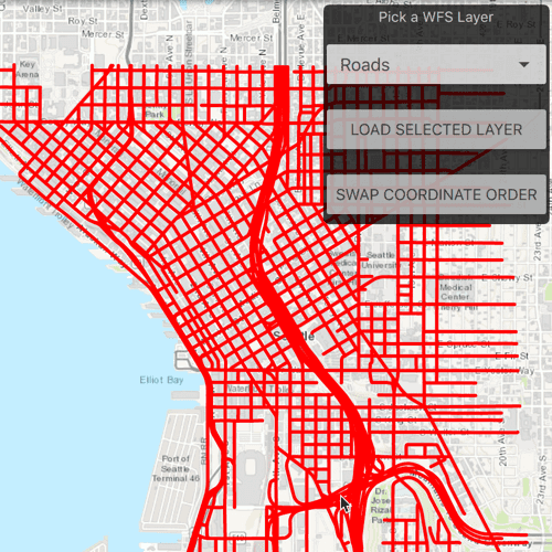
Services often have multiple layers available for display. For example, a feature service for a city might have layers representing roads, land masses, building footprints, parks, and facilities. A user can choose to only show the road network and parks for a park accessibility analysis.
How to use the sample
A list of layers in the WFS service will be shown. Select a layer to display.
Some WFS services return coordinates in X,Y order, while others return coordinates in lat/long (Y,X) order. If you don't see features rendered or you see features in the wrong location, click on "Swap Coordinate Order".
How it works
- Create a
WfsServiceobject with a URL to a WFS feature service. - Obtain a list of
WfsLayerInfofromWfsService.ServiceInfo. - When a layer is selected, create a
WfsFeatureTablefrom theWfsLayerInfo.- Set the axis order if necessary.
- Create a feature layer from the feature table.
- Add the feature layer to the map.
- The sample uses randomly-generated symbology, similar to the behavior in ArcGIS Pro.
Relevant API
- FeatureLayer
- WfsLayerInfo
- WfsService
- WfsServiceInfo
- WfsFeatureTable
- WfsFeatureTable.AxisOrder
About the data
This service shows features for downtown Seattle. For additional information, see the underlying service on ArcGIS Online.
Tags
browse, catalog, feature, layers, OGC, service, web, WFS
Sample Code
// [WriteFile Name=BrowseWfsLayers, Category=Layers]
// [Legal]
// Copyright 2019 Esri.
// Licensed under the Apache License, Version 2.0 (the "License");
// you may not use this file except in compliance with the License.
// You may obtain a copy of the License at
// http://www.apache.org/licenses/LICENSE-2.0
// Unless required by applicable law or agreed to in writing, software
// distributed under the License is distributed on an "AS IS" BASIS,
// WITHOUT WARRANTIES OR CONDITIONS OF ANY KIND, either express or implied.
// See the License for the specific language governing permissions and
// limitations under the License.
// [Legal]
import QtQuick
import Esri.ArcGISRuntime
import QtQuick.Controls
import QtQuick.Layouts
Rectangle {
id: rootRectangle
clip: true
width: 800
height: 600
readonly property url serviceUrl: "https://dservices2.arcgis.com/ZQgQTuoyBrtmoGdP/arcgis/services/Seattle_Downtown_Features/WFSServer?service=wfs&request=getcapabilities"
property ListModel myWfsListModel: ListModel{}
property var wfsLayersInfoList: []
property var wfsFeatureTable
property bool swapAxis: false
MapView {
id: mapView
anchors.fill: parent
Component.onCompleted: {
// Set the focus on MapView to initially enable keyboard navigation
forceActiveFocus();
}
Map {
Basemap {
initStyle: Enums.BasemapStyleArcGISTopographic
}
onComponentCompleted: createWfsService();
}
BusyIndicator {
id: loadingIndicator
anchors.horizontalCenter: parent.horizontalCenter
anchors.verticalCenter: parent.verticalCenter
running: false;
}
Rectangle {
anchors {
margins: 5
right: parent.right
top: parent.top
}
width: childrenRect.width
height: childrenRect.height
color: "#000000"
opacity: .75
radius: 5
ColumnLayout {
Text {
color: "#ffffff"
text: qsTr("Pick a WFS Layer")
Layout.margins: 3
Layout.alignment: Qt.AlignHCenter
}
ComboBox {
id: layersComboBox
model: myWfsListModel
currentIndex: 0
Layout.fillWidth: true
Layout.margins: 3
Layout.alignment: Qt.AlignHCenter
// Add a background to the ComboBox
Rectangle {
anchors.fill: parent
radius: 10
// Make the rectangle visible if a dropdown indicator exists
// An indicator only exists if a theme is set
visible: parent.indicator
border.width: 1
}
}
Button {
id: loadSelectedLayerBtn
text: qsTr("Load Selected Layer")
Layout.fillWidth: true
Layout.margins: 3
onClicked: {
swapAxis = false;
createWfsFeatureTable();
}
}
Button {
id: swapAxisOrder
text: qsTr("Swap Coordinate Order")
Layout.margins: 3
Layout.fillWidth: true
onClicked:{
swapAxis = !swapAxis;
createWfsFeatureTable();
}
}
}
}
}
function createWfsService() {
// create WFS Service
const service = ArcGISRuntimeEnvironment.createObject("WfsService", {url: serviceUrl});
// once WFS service is laoded create ListModel from Layer titles for ComboBox and create WFS Feature Table
service.loadStatusChanged.connect(()=> {
if (service.loadStatus === Enums.LoadStatusLoaded) {
wfsLayersInfoList = service.serviceInfo.layerInfos;
//once loaded populate myWfsListModel with titles from the service to display in a comboBox
for (let i in wfsLayersInfoList){
const data = {"title": wfsLayersInfoList[i].title};
myWfsListModel.append(data);
}
}
});
service.load();
}
function createWfsFeatureTable() {
// enable busy indicator
loadingIndicator.running = true;
// clear previous layer
mapView.map.operationalLayers.clear();
// create WFS Feature Table from selected layer
wfsFeatureTable = ArcGISRuntimeEnvironment.createObject("WfsFeatureTable", {layerInfo: wfsLayersInfoList[layersComboBox.currentIndex]});
// Set feature request mode to manual - only manual is supported at v100.5.
// In this mode, you must manually populate the table - panning and zooming
// won't request features automatically.
wfsFeatureTable.featureRequestMode = Enums.FeatureRequestModeManualCache;
if (swapAxis) {
wfsFeatureTable.axisOrder = Enums.OgcAxisOrderSwap;
} else {
wfsFeatureTable.axisOrder = Enums.OgcAxisOrderNoSwap;
}
// once WFS Feature Table is loaded, populate the table and add the layer to the map
wfsFeatureTable.loadStatusChanged.connect(()=> {
if (wfsFeatureTable.loadStatus !== Enums.LoadStatusLoaded)
return;
populateWfsFeatureTable();
});
wfsFeatureTable.load();
}
function populateWfsFeatureTable() {
// Create query parameters
const params = ArcGISRuntimeEnvironment.createObject("QueryParameters", {
geometry: mapView.visibleArea.extent,
spatialRelationship: Enums.SpatialRelationshipIntersects
});
wfsFeatureTable.populateFromServiceStatusChanged.connect(()=> {
if(wfsFeatureTable.populateFromServiceStatus !== Enums.TaskStatusCompleted)
return;
addFeatureLayerToMap();
// set viewpoint to extent of selected layer
mapView.setViewpointGeometry(wfsFeatureTable.extent);
});
// Populate features based on query
wfsFeatureTable.populateFromService(params, false, ["*"]);
}
function addFeatureLayerToMap() {
let simpleSymbol;
let symbolLine;
// appropriate symbology for each corresponding geometry type
switch (wfsFeatureTable.geometryType) {
case Enums.GeometryTypePoint:
simpleSymbol = ArcGISRuntimeEnvironment.createObject("SimpleMarkerSymbol", {
color: "green",
outline: symbolLine,
size: 4,
style: Enums.SimpleMarkerSymbolStyleCircle
});
break;
case Enums.GeometryTypePolygon:
simpleSymbol = ArcGISRuntimeEnvironment.createObject("SimpleLineSymbol", {
color: "blue",
width: 3,
style: Enums.SimpleLineSymbolStyleSolid
});
break;
case Enums.GeometryTypePolyline:
simpleSymbol = ArcGISRuntimeEnvironment.createObject("SimpleLineSymbol", {
color: "red",
width: 3,
style: Enums.SimpleLineSymbolStyleSolid
});
break;
case Enums.GeometryTypeUnknown:
case Enums.GeometryTypeEnvelope:
case Enums.GeometryTypeEnvelope:
console.debug("Error! No Renderer defined for this GeometryType");
return;
}
const simpleRenderer = ArcGISRuntimeEnvironment.createObject("SimpleRenderer",{symbol: simpleSymbol});
const featureLayer = ArcGISRuntimeEnvironment.createObject("FeatureLayer", {
featureTable: wfsFeatureTable,
renderer: simpleRenderer
});
// add the layer to the map
mapView.map.operationalLayers.append(featureLayer);
// disable busy indicator
loadingIndicator.running = false;
}
}