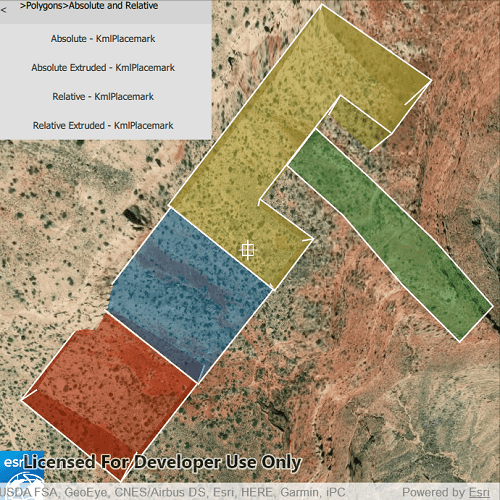
List the contents of a KML file.
Use case
KML files can contain a hierarchy of features, including network links to other KML content. A user may wish to traverse through the contents of KML nodes to know what data is contained within each node and, recursively, their children.
How to use the sample
The contents of the KML file are shown in a list of buttons. Select a node to zoom to that node and see its child nodes, if it has any. Not all nodes can be zoomed to (e.g. screen overlays).
How it works
- Add the KML file to the scene as a layer.
- Explore the root nodes of the
KmlDatasetrecursively to create a view model.
- Each node is enabled for display at this step. KML files may include nodes that are turned off by default.
- When a node is selected, use the node's
Extentto determine a viewpoint and set theSceneViewobject's viewpoint to it.
Relevant API
- KmlDataset
- KmlDocument
- KmlFolder
- KmlGroundOverlay
- KmlLayer
- KmlNode
- KmlPlacemark
- KmlScreenOverlay
Offline data
To set up the sample's offline data, see the Use offline data in the samples section of the Qt Samples repository overview.
| Link | Local Location |
|---|---|
| ESRI test data | <userhome>/ArcGIS/Runtime/Data/kml/esri_test_data.kmz |
About the data
This is an example KML file meant to demonstrate how the ArcGIS Maps SDK for Qt supports several common features.
Tags
Keyhole, KML, KMZ, layers, OGC
Sample Code
ListKmlContents.qml
// [WriteFile Name=ListKmlContents, Category=Layers]
// [Legal]
// Copyright 2020 Esri.
// Licensed under the Apache License, Version 2.0 (the "License");
// you may not use this file except in compliance with the License.
// You may obtain a copy of the License at
// http://www.apache.org/licenses/LICENSE-2.0
// Unless required by applicable law or agreed to in writing, software
// distributed under the License is distributed on an "AS IS" BASIS,
// WITHOUT WARRANTIES OR CONDITIONS OF ANY KIND, either express or implied.
// See the License for the specific language governing permissions and
// limitations under the License.
// [Legal]
import QtQuick
import QtQuick.Controls
import QtQuick.Layouts
import Esri.ArcGISRuntime
import Esri.ArcGISExtras
Rectangle {
id: rootRectangle
clip: true
width: 800
height: 600
readonly property url dataPath: {
Qt.platform.os === "ios" ?
System.writableLocationUrl(System.StandardPathsDocumentsLocation) + "/ArcGIS/Runtime/Data/kml/" :
System.writableLocationUrl(System.StandardPathsHomeLocation) + "/ArcGIS/Runtime/Data/kml/"
}
property var nodesOnLevel: []
property var kmlNodesList: []
property var currentNode: null
property var currentViewpoint: null
property var currentCamera: null
property string labelText: ""
property bool topLevel: true
property bool needsAltitudeFixed
// recursively build list of nodes
function buildTree(parentNode) {
let childNodes = parentNode.childNodesListModel;
if (childNodes !== undefined && childNodes !== null) {
for (let i = 0; i < childNodes.count; i++) {
let node = childNodes.get(i);
node.visible = true;
kmlNodesList.push(node);
buildTree(node);
}
}
}
// recursively build string to indicate node's ancestors
function buildPathLabel(node) {
if (node.parentNode !== undefined && node.parentNode !== null) {
buildPathLabel(node.parentNode);
labelText = labelText.concat(">");
}
labelText = labelText.concat(node.name);
}
function displayChildren(parentNode) {
// if node has children, then display children
if (parentNode.childNodesListModel !== null && parentNode.childNodesListModel !== undefined) {
let childNodes = parentNode.childNodesListModel
let lastLevel = true;
// clear previous node names
nodesOnLevel = [];
for (let i = 0; i < childNodes.count; i++) {
let node = childNodes.get(i);
nodesOnLevel.push(node.name + getKmlNodeType(node));
// check if on last level of nodes
if (node.childNodesListModel !== undefined && node.childNodesListModel !== null) {
nodesOnLevel[i] = nodesOnLevel[i].concat(" >"); // indicate there are children
lastLevel = false;
}
}
myListView.model = nodesOnLevel;
if (lastLevel) {
currentNode = childNodes.get(0);
}
}
}
// display selected node on sceneview and show its children
function processSelectedNode(nodeName) {
// extract the node name from string, formatted "name - nodeType"
let ind = nodeName.lastIndexOf(" - ");
if (ind > -1) {
nodeName = nodeName.substring(0, ind);
}
// find node with matching name
for (let i = 0; i < kmlNodesList.length; i++) {
if (nodeName === kmlNodesList[i].name) {
topLevel = false;
let node = kmlNodesList[i];
currentNode = node;
// set the viewpoint to the extent of the selected node
getViewpointFromKmlViewpoint(currentNode);
if (needsAltitudeFixed) {
getAltitudeAdjustedViewpoint(currentNode);
} else {
if (currentViewpoint !== null && currentViewpoint !== undefined) {
sceneView.setViewpoint(currentViewpoint);
}
}
// update path label
labelText = "";
buildPathLabel(node);
// show the children of the node
displayChildren(node);
break;
}
}
}
function getViewpointFromKmlViewpoint(node) {
const kmlViewpoint = node.viewpoint;
if (kmlViewpoint !== undefined && kmlViewpoint !== null) {
// altitude adjustment is needed for all but Absolute altitude mode
needsAltitudeFixed = (kmlViewpoint.altitudeMode !== Enums.KmlAltitudeModeAbsolute);
switch (kmlViewpoint.type) {
case Enums.KmlViewpointTypeLookAt:
currentCamera = ArcGISRuntimeEnvironment.createObject("Camera", {
location: kmlViewpoint.location,
distance: kmlViewpoint.range,
heading: kmlViewpoint.heading,
pitch: kmlViewpoint.pitch,
roll: kmlViewpoint.roll
});
currentViewpoint = ArcGISRuntimeEnvironment.createObject("ViewpointCenter", {center: kmlViewpoint.location,
camera: currentCamera});
return;
case Enums.KmlViewpointTypeCamera:
currentCamera = ArcGISRuntimeEnvironment.createObject("Camera", {
location: kmlViewpoint.location,
heading: kmlViewpoint.heading,
pitch: kmlViewpoint.pitch,
roll: kmlViewpoint.roll
});
currentViewpoint = ArcGISRuntimeEnvironment.createObject("ViewpointCenter", {center: kmlViewpoint.location,
camera: currentCamera});
return;
default:
console.warn("Unexpected KmlViewpointType");
return;
}
}
// if viewpoint is empty then use node's extent
const nodeExtent = node.extent;
if (nodeExtent !== null && nodeExtent !== undefined && !nodeExtent.empty) {
// when no altitude is specified, assume elevation needs to be adjusted
needsAltitudeFixed = true;
if (nodeExtent.width === 0 && nodeExtent.height === 0) {
currentViewpoint = ArcGISRuntimeEnvironment.createObject("ViewpointExtent", {extent: nodeExtent});
currentCamera = ArcGISRuntimeEnvironment.createObject("Camera", {
location: nodeExtent.center,
distance: 1000,
heading: 0,
pitch: 45,
roll: 0
});
sceneView.setViewpointCameraAndWait(currentCamera);
return;
} else {
// add padding to extent
const bufferDistance = Math.max(nodeExtent.width, nodeExtent.height) / 20;
const spatialReferenceWgs84 = ArcGISRuntimeEnvironment.createObject("SpatialReference", {wkid: 4326});
const bufferedExtent = ArcGISRuntimeEnvironment.createObject("Envelope", {
xMin: nodeExtent.xMin - bufferDistance,
yMin: nodeExtent.yMin - bufferDistance,
xMax: nodeExtent.xMax + bufferDistance,
yMax: nodeExtent.yMax + bufferDistance,
zMin: nodeExtent.zMin - bufferDistance,
zMax: nodeExtent.zMax + bufferDistance,
spatialReference: spatialReferenceWgs84
});
currentViewpoint = ArcGISRuntimeEnvironment.createObject("ViewpointExtent", {extent: bufferedExtent});
}
} else {
// can't show viewpoint
needsAltitudeFixed = false;
currentViewpoint = ArcGISRuntimeEnvironment.createObject("ViewpointCenter");
}
}
function getAltitudeAdjustedViewpoint(node) {
// assume altitude mode is clamp-to-ground if not specified
let altMode = Enums.KmlAltitudeModeClampToGround;
let kmlViewpoint = node.viewpoint;
if (kmlViewpoint !== undefined && kmlViewpoint !== null) {
altMode = kmlViewpoint.altitudeMode;
}
// if altitude mode is Absolute, viewpoint doesn't need adjustment
if (altMode === Enums.KmlAltitudeModeAbsolute) {
return;
}
if (currentViewpoint.viewpointType === Enums.ViewpointTypeBoundingGeometry) {
scene.baseSurface.locationToElevation(currentViewpoint.extent.center);
}
else if (currentViewpoint.viewpointType === Enums.ViewpointTypeCenterAndScale) {
scene.baseSurface.locationToElevation(currentViewpoint.center);
}
}
// returns string containing the KmlNodeType
function getKmlNodeType(node) {
let type = "";
switch(node.kmlNodeType) {
case Enums.KmlNodeTypeKmlDocument:
type = "KmlDocument";
break;
case Enums.KmlNodeTypeKmlFolder:
type = "KmlFolder";
break;
case Enums.KmlNodeTypeKmlGroundOverlay:
type = "KmlGroundOverlay";
break;
case Enums.KmlNodeTypeKmlNetworkLink:
type = "KmlNetworkLink";
break;
case Enums.KmlNodeTypeKmlPhotoOverlay:
type = "KmlPhotoOverlay";
break;
case Enums.KmlNodeTypeKmlPlacemark:
type = "KmlPlacemark";
break;
case Enums.KmlNodeTypeKmlScreenOverlay:
type = "KmlScreenOverlay";
break;
case Enums.KmlNodeTypeKmlTour:
type = "KmlTour";
break;
}
return " - " + type;
}
SceneView {
id: sceneView
anchors.fill: parent
Component.onCompleted: {
// Set the focus on SceneView to initially enable keyboard navigation
forceActiveFocus();
}
// create window for displaying the KML contents
Control {
width: 300
background : Rectangle {
color: "lightgrey"
}
contentItem: GridLayout {
columns: 2
Button {
id: backButton
Layout.margins: 3
text: "<"
enabled: !topLevel
flat: true
highlighted: pressed
onClicked: {
// display previous level of nodes
let parentNode = currentNode.parentNode;
let grandparentNode = parentNode.parentNode;
if (grandparentNode !== undefined && grandparentNode !== null) {
labelText = "";
buildPathLabel(grandparentNode);
displayChildren(grandparentNode);
currentNode = grandparentNode;
}
// if parent node is undefined, then at top of tree
else {
labelText = "";
buildPathLabel(parentNode);
displayChildren(parentNode);
topLevel = true;
}
if (currentNode.name === "") {
topLevel = true;
}
}
}
Text {
Layout.fillWidth: true
id: textLabel
text: labelText
wrapMode: Text.Wrap
}
ListView {
id: myListView
Layout.columnSpan: 2
Layout.fillWidth: true
model: nodesOnLevel
Layout.preferredHeight: contentHeight
delegate: Component {
Button {
text: modelData
anchors {
left: parent.left
right: parent.right
}
onClicked: {
processSelectedNode(text);
}
highlighted: pressed
}
}
}
}
}
Scene {
id: scene
Basemap {
initStyle: Enums.BasemapStyleArcGISImagery
}
Surface {
ArcGISTiledElevationSource {
url: "https://elevation3d.arcgis.com/arcgis/rest/services/WorldElevation3D/Terrain3D/ImageServer"
}
onLocationToElevationStatusChanged: {
if (locationToElevationStatus !== Enums.TaskStatusCompleted)
return;
// assume altitude mode is clamp-to-ground if not specified
let altMode = Enums.KmlAltitudeModeClampToGround;
let kmlViewpoint = currentNode.viewpoint;
if (kmlViewpoint !== undefined && kmlViewpoint !== null) {
altMode = kmlViewpoint.altitudeMode;
}
// if altitude mode is Absolute, viewpoint doesn't need adjustment
if (altMode === Enums.KmlAltitudeModeAbsolute)
return;
if (currentViewpoint.viewpointType === Enums.ViewpointTypeBoundingGeometry) {
let lookAtExtent = currentViewpoint.extent;
let target = null;
if (altMode === Enums.KmlAltitudeModeClampToGround) {
// if depth of extent = 0, add 100m to the elevation to get zMax
if (lookAtExtent.depth === 0) {
target = ArcGISRuntimeEnvironment.createObject("Envelope",{
xMin: lookAtExtent.xMin,
yMin: lookAtExtent.yMin,
xMax: lookAtExtent.xMax,
yMax: lookAtExtent.yMax,
zMin: locationToElevationResult,
zMax: locationToElevationResult + 100,
spatialReference: lookAtExtent.spatialReference
});
} else {
target = ArcGISRuntimeEnvironment.createObject("Envelope",{
xMin: lookAtExtent.xMin,
yMin: lookAtExtent.yMin,
xMax: lookAtExtent.xMax,
yMax: lookAtExtent.yMax,
zMin: locationToElevationResult,
// set the camera slightly above the placemark by adding one meter
zMax: lookAtExtent.depth + locationToElevationResult + 1,
spatialReference: lookAtExtent.spatialReference
});
}
} else {
target = ArcGISRuntimeEnvironment.createObject("Envelope",{
xMin: lookAtExtent.xMin,
yMin: lookAtExtent.yMin,
xMax: lookAtExtent.xMax,
yMax: lookAtExtent.yMax,
zMin: lookAtExtent.zMin + locationToElevationResult,
zMax: lookAtExtent.zMax + locationToElevationResult,
spatialReference: lookAtExtent.spatialReference
});
}
// if node has viewpoint specified, return adjusted geometry with adjusted camera
if (kmlViewpoint !== undefined && kmlViewpoint !== null) {
sceneView.setViewpointCameraAndWait(currentViewpoint.camera.elevate(locationToElevationResult));
currentViewpoint = ArcGISRuntimeEnvironment.createObject("ViewpointExtent", {extent: target});
sceneView.setViewpoint(currentViewpoint);
return;
} else {
currentViewpoint = ArcGISRuntimeEnvironment.createObject("ViewpointExtent", {extent: target});
sceneView.setViewpoint(currentViewpoint);
return;
}
} else if (currentViewpoint.viewpointType === Enums.ViewpointTypeCenterAndScale) {
let targetPoint = null;
let lookAtPoint = currentViewpoint.center;
if (altMode === Enums.KmlAltitudeModeClampToGround) {
targetPoint = ArcGISRuntimeEnvironment.createObject("Point", {
x: lookAtPoint.x, y: lookAtPoint.y,
z: locationToElevationResult,
spatialReference: lookAtPoint.spatialReference
});
} else {
targetPoint = ArcGISRuntimeEnvironment.createObject("Point", {
x: lookAtPoint.x, y: lookAtPoint.y,
z: lookAtPoint.z + locationToElevationResult,
spatialReference: lookAtPoint.spatialReference
});
}
// set the viewpoint using the adjusted target
if (kmlViewpoint !== undefined && kmlViewpoint !== null) {
sceneView.setViewpointCameraAndWait(currentViewpoint.camera.elevate(locationToElevationResult));
currentViewpoint = ArcGISRuntimeEnvironment.createObject("ViewpointCenter", {center: targetPoint});
return;
} else {
// use Google Earth default values to set camera
currentViewpoint = ArcGISRuntimeEnvironment.createObject("ViewpointCenter", {center: targetPoint});
sceneView.setViewpoint(currentViewpoint);
currentCamera = ArcGISRuntimeEnvironment.createObject("Camera", {
location: targetPoint,
distance: 1000,
heading: 0,
pitch: 45,
roll: 0
});
sceneView.setViewpointCameraAndWait(currentCamera);
return;
}
}
}
}
KmlLayer {
KmlDataset {
id: kmlDataset
url: dataPath + "esri_test_data.kmz"
onLoadStatusChanged: {
if (loadStatus !== Enums.LoadStatusLoaded)
return;
for (let i = 0; i < rootNodes.length; i++) {
nodesOnLevel.push(rootNodes[i].name);
kmlNodesList.push(rootNodes[i]);
buildTree(rootNodes[i]);
}
// if at top node, then display children
if (kmlNodesList.length !== 0 && kmlNodesList[0].parentNode === null) {
displayChildren(kmlNodesList[0]);
}
}
}
}
}
}
}