Add, delete, and download attachments for features from a service.
Use case
Attachments provide a flexible way to manage additional information that is related to your features. Attachments allow you to add files to individual features, including: PDFs, text documents, or any other type of file. For example, if you have a feature representing a building, you could use attachments to add multiple photographs of the building taken from several angles, along with PDF files containing the building's deed and tax information.
How to use the sample
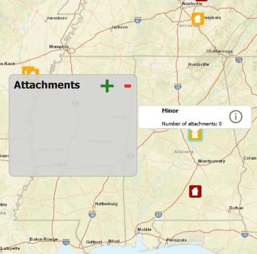
Tap a feature on the map to open a callout displaying the number of attachments. Tap on the info button to view/edit the attachments. Select an entry from the list to download and view the attachment in the gallery. Tap on the floating action button '+' or '-' too add or remove an attachment.
How it works
- Create a
ServiceFeatureTablefrom a URL. - Create a
FeatureLayerobject from the service feature table. - Select features from the feature layer with
selectFeatures. - To fetch the feature's attachments, cast to an
ArcGISFeatureand useArcGISFeature::attachments(). - To add an attachment to the selected ArcGISFeature, create an attachment and use
ArcGISFeature::attachments()::addAttachmentAsync(). - To delete an attachment from the selected ArcGISFeature, use the
ArcGISFeature.deleteAttachmentAsync(). - By default, edits are automatically applied to the service and
applyEditsAsyncdoes not need to be called.
Additional information
Attachments can only be added to and accessed on service feature tables when their hasAttachments property is true.
Relevant API
- ApplyEditsAsync
- AttachmentListModel
- DeleteAttachmentAsync
- FeatureLayer
- FetchAttachmentsAsync
- FetchDataAsync
- ServiceFeatureTable
- UpdateFeatureAsync
Tags
Edit and Manage Data, image, JPEG, picture, PDF, PNG, TXT
Sample Code
// [WriteFile Name=EditFeatureAttachments, Category=EditData]
// [Legal]
// Copyright 2016 Esri.
//
// Licensed under the Apache License, Version 2.0 (the "License");
// you may not use this file except in compliance with the License.
// You may obtain a copy of the License at
// http://www.apache.org/licenses/LICENSE-2.0
//
// Unless required by applicable law or agreed to in writing, software
// distributed under the License is distributed on an "AS IS" BASIS,
// WITHOUT WARRANTIES OR CONDITIONS OF ANY KIND, either express or implied.
// See the License for the specific language governing permissions and
// limitations under the License.
// [Legal]
#ifdef PCH_BUILD
#include "pch.hpp"
#endif // PCH_BUILD
// sample headers
#include "EditFeatureAttachments.h"
// ArcGIS Maps SDK headers
#include "ArcGISFeature.h"
#include "Attachment.h"
#include "AttachmentListModel.h"
#include "AttributeListModel.h"
#include "Basemap.h"
#include "CalloutData.h"
#include "Envelope.h"
#include "Error.h"
#include "Feature.h"
#include "FeatureEditResult.h"
#include "FeatureIterator.h"
#include "FeatureLayer.h"
#include "FeatureQueryResult.h"
#include "IdentifyLayerResult.h"
#include "LayerListModel.h"
#include "Map.h"
#include "MapQuickView.h"
#include "MapTypes.h"
#include "MapViewTypes.h"
#include "Point.h"
#include "QueryParameters.h"
#include "ServiceFeatureTable.h"
#include "SpatialReference.h"
#include "Viewpoint.h"
// Qt headers
#include <QFile>
#include <QFileInfo>
#include <QMouseEvent>
#include <QUrl>
#include <QUuid>
using namespace Esri::ArcGISRuntime;
namespace
{
// Convenience RAII struct that deletes all pointers in given container.
struct FeatureEditListResultLock
{
FeatureEditListResultLock(const QList<FeatureEditResult*>& list) : results(list) { }
~FeatureEditListResultLock() { qDeleteAll(results); }
const QList<FeatureEditResult*>& results;
};
}
EditFeatureAttachments::EditFeatureAttachments(QQuickItem* parent) :
QQuickItem(parent)
{
}
EditFeatureAttachments::~EditFeatureAttachments() = default;
void EditFeatureAttachments::init()
{
qmlRegisterType<MapQuickView>("Esri.Samples", 1, 0, "MapView");
qmlRegisterType<EditFeatureAttachments>("Esri.Samples", 1, 0, "EditFeatureAttachmentsSample");
qmlRegisterUncreatableType<QAbstractListModel>("Esri.Samples", 1, 0, "AbstractListModel", "AbstractListModel is uncreateable");
qmlRegisterUncreatableType<CalloutData>("Esri.Samples", 1, 0, "CalloutData", "CalloutData is an uncreatable type");
}
void EditFeatureAttachments::componentComplete()
{
QQuickItem::componentComplete();
// find QML MapView component
m_mapView = findChild<MapQuickView*>("mapView");
m_mapView->setWrapAroundMode(WrapAroundMode::Disabled);
// create a Map by passing in the Basemap
m_map = new Map(BasemapStyle::ArcGISStreets, this);
m_map->setInitialViewpoint(Viewpoint(Point(-10800000, 4500000, SpatialReference(102100)), 3e7));
// set map on the map view
m_mapView->setMap(m_map);
// create the ServiceFeatureTable
m_featureTable = new ServiceFeatureTable(QUrl("https://sampleserver6.arcgisonline.com/arcgis/rest/services/DamageAssessment/FeatureServer/0"), this);
// create the FeatureLayer with the ServiceFeatureTable and add it to the Map
m_featureLayer = new FeatureLayer(m_featureTable, this);
m_map->operationalLayers()->append(m_featureLayer);
connectSignals();
}
void EditFeatureAttachments::connectSignals()
{
// connect to the mouse clicked signal on the MapQuickView
connect(m_mapView, &MapQuickView::mouseClicked, this, [this](QMouseEvent& mouseEvent)
{
// first clear the selection
m_featureLayer->clearSelection();
// set the properties for qml
emit hideWindow();
// call identify on the map view
m_mapView->identifyLayerAsync(m_featureLayer, mouseEvent.position(), 5, false, 1).then(this, [this](IdentifyLayerResult* identifyResult)
{
onIdentifyLayerCompleted_(identifyResult);
});
});
// connect to the viewpoint changed signal on the MapQuickView
connect(m_mapView, &MapQuickView::viewpointChanged, this, [this]()
{
m_featureLayer->clearSelection();
emit hideWindow();
});
}
QAbstractListModel* EditFeatureAttachments::attachmentModel() const
{
return m_selectedFeature ? m_selectedFeature->attachments(false, false) : nullptr;
}
void EditFeatureAttachments::addAttachment(const QUrl& fileUrl, const QString& contentType)
{
if (QFile::exists(fileUrl.toLocalFile()))
{
const QFileInfo fileInfo(fileUrl.path());
const QString fileName = fileInfo.fileName();
disconnect(m_attachmentConnection); // disconnect previous connection if necessary
if (m_selectedFeature->loadStatus() == LoadStatus::Loaded)
{
QFile file(fileUrl.toLocalFile());
m_selectedFeature->attachments(false, false)->addAttachmentAsync(file, contentType, fileName).then(this , [this](QFuture<Attachment*>)
{
applyEdits();
});
}
else
{
m_attachmentConnection = connect(m_selectedFeature, &ArcGISFeature::loadStatusChanged,
this, [this, fileUrl, contentType, fileName](Esri::ArcGISRuntime::LoadStatus)
{
if (m_selectedFeature->loadStatus() == LoadStatus::Loaded)
{
QFile file(fileUrl.toLocalFile());
disconnect(m_attachmentConnection);
m_selectedFeature->attachments(false, false)->addAttachmentAsync(file, contentType, fileName).then(this , [this](QFuture<Attachment*>)
{
applyEdits();
});
}
});
m_selectedFeature->load();
}
}
}
void EditFeatureAttachments::deleteAttachment(int index)
{
disconnect(m_attachmentConnection); // disconnect previous connection if necessary
if (m_selectedFeature->loadStatus() == LoadStatus::Loaded)
{
qDebug() << "Attachments size: " << m_selectedFeature->attachments(false, false)->rowCount();
m_selectedFeature->attachments(false, false)->deleteAttachmentAsync(index).then(this, [this]()
{
applyEdits();
});
}
else
{
m_attachmentConnection = connect(m_selectedFeature, &ArcGISFeature::loadStatusChanged,
this, [this, index](Esri::ArcGISRuntime::LoadStatus)
{
if (m_selectedFeature->loadStatus() == LoadStatus::Loaded)
{
disconnect(m_attachmentConnection);
m_selectedFeature->attachments(false, false)->deleteAttachmentAsync(index).then(this, [this]()
{
applyEdits();
});
}
});
m_selectedFeature->load();
}
}
// process identifyLayerAsync completion on the map view
void EditFeatureAttachments::onIdentifyLayerCompleted_(IdentifyLayerResult* identifyResult)
{
if (!identifyResult)
return;
if (!identifyResult->geoElements().empty())
{
// select the item in the result
m_featureLayer->selectFeature(static_cast<Feature*>(identifyResult->geoElements().at(0)));
// obtain the selected feature with attributes
QueryParameters queryParams;
m_whereClause = "objectid=" + identifyResult->geoElements().at(0)->attributes()->attributeValue("objectid").toString();
queryParams.setWhereClause(m_whereClause);
m_featureTable->queryFeaturesAsync(queryParams).then(this, [this](FeatureQueryResult* featureQueryResult)
{
onQueryFeaturesCompleted_(featureQueryResult);
});
}
}
void EditFeatureAttachments::onQueryFeaturesCompleted_(FeatureQueryResult* featureQueryResult)
{
if (featureQueryResult && featureQueryResult->iterator().hasNext())
{
// first delete if not nullptr
if (m_selectedFeature)
delete m_selectedFeature;
// set selected feature and attachment model members
m_selectedFeature = static_cast<ArcGISFeature*>(featureQueryResult->iterator().next(this));
// Don't delete selected feature when parent featureQueryResult is deleted.
m_selectedFeature->setParent(this);
const QString featureType = m_selectedFeature->attributes()->attributeValue(QStringLiteral("typdamage")).toString();
m_mapView->calloutData()->setLocation(m_selectedFeature->geometry().extent().center());
m_mapView->calloutData()->setTitle(QString("<b>%1</b>").arg(featureType));
emit featureSelected();
emit attachmentModelChanged();
// get the number of attachments
// enableAutoFetch and enableAutoApplyEdits for AttachmentListModel are set as false
// to avoid automatic behavior. We will call fetchDataAsync explicitly as needed.
m_selectedFeature->attachments(false, false)->fetchAttachmentsAsync().then(this, [this](const QList<Attachment*>& attachments)
{
m_mapView->calloutData()->setDetail(QString("Number of attachments: %1").arg(attachments.size()));
m_mapView->calloutData()->setVisible(true); // Resizes the calloutData after details has been set.
});
}
}
// process completion of applyEditsAsync from the ServiceFeatureTable
void EditFeatureAttachments::onApplyEditsCompleted_(const QList<FeatureEditResult*>& featureEditResults)
{
// Lock is a convenience wrapper that deletes the contents of featureEditResults when we leave scope.
FeatureEditListResultLock lock(featureEditResults);
if (lock.results.length() > 0)
{
// obtain the first item in the list
FeatureEditResult* featureEditResult = lock.results.first();
// check if there were errors
if (!featureEditResult->isCompletedWithErrors())
{
qDebug() << "Successfully edited feature attachments";
// update the selected feature with attributes
QueryParameters queryParams;
queryParams.setWhereClause(m_whereClause);
m_featureTable->queryFeaturesAsync(queryParams).then(this, [this](FeatureQueryResult* featureQueryResult)
{
onQueryFeaturesCompleted_(featureQueryResult);
});
}
else
{
qDebug() << "Apply edits error:" << featureEditResult->error().message();
}
}
}
void EditFeatureAttachments::applyEdits()
{
m_featureTable->applyEditsAsync(this).then(this, [this](const QList<FeatureEditResult*>& featureEditResults)
{
onApplyEditsCompleted_(featureEditResults);
});
}