Identify features in a scene to select.
Use case
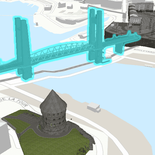
You can select features to visually distinguish them with a selection color or highlighting. This can be useful to demonstrate the physical extent or associated attributes of a feature, or to initiate another action such as centering that feature in the scene view.
How to use the sample
Click on a building in the scene layer to select it. Deselect buildings by clicking away from the buildings.
How it works
- Create an
ArcGISSceneLayerpassing in the URL to a scene layer service. - Use
SceneView::mouseClickedsignal to get the screen tap locationscreenPoint. - Call
SceneView::identifyLayerAsyncto identify features in the scene that intersect the tapped screen point. - From the resulting
IdentifyLayerResult, a list of identifiedGeoElementsare obtained. - Get the first element in the list, checking that it is a feature, and call
ArcGISSceneLayer::selectFeature(feature)to select it.
Relevant API
- ArcGISSceneLayer
- Scene
- SceneView
About the data
This sample shows a Brest France Buildings Scene hosted on ArcGIS Online.
Tags
3D, buildings, identify, model, query, search, select
Sample Code
// [WriteFile Name=SceneLayerSelection, Category=Scenes]
// [Legal]
// Copyright 2018 Esri.
//
// Licensed under the Apache License, Version 2.0 (the "License");
// you may not use this file except in compliance with the License.
// You may obtain a copy of the License at
// http://www.apache.org/licenses/LICENSE-2.0
//
// Unless required by applicable law or agreed to in writing, software
// distributed under the License is distributed on an "AS IS" BASIS,
// WITHOUT WARRANTIES OR CONDITIONS OF ANY KIND, either express or implied.
// See the License for the specific language governing permissions and
// limitations under the License.
// [Legal]
#ifdef PCH_BUILD
#include "pch.hpp"
#endif // PCH_BUILD
// sample headers
#include "SceneLayerSelection.h"
// ArcGIS Maps SDK headers
#include "ArcGISSceneLayer.h"
#include "ArcGISTiledElevationSource.h"
#include "Basemap.h"
#include "Camera.h"
#include "ElevationSourceListModel.h"
#include "Feature.h"
#include "IdentifyLayerResult.h"
#include "LayerListModel.h"
#include "MapTypes.h"
#include "Point.h"
#include "Scene.h"
#include "SceneQuickView.h"
#include "SpatialReference.h"
#include "Surface.h"
#include "Viewpoint.h"
// Qt headers
#include <QFuture>
#include <QUuid>
using namespace Esri::ArcGISRuntime;
SceneLayerSelection::SceneLayerSelection(QQuickItem* parent /* = nullptr */):
QQuickItem(parent)
{
}
void SceneLayerSelection::init()
{
// Register classes for QML
qmlRegisterType<SceneQuickView>("Esri.Samples", 1, 0, "SceneView");
qmlRegisterType<SceneLayerSelection>("Esri.Samples", 1, 0, "SceneLayerSelectionSample");
}
void SceneLayerSelection::componentComplete()
{
QQuickItem::componentComplete();
m_sceneView = findChild<SceneQuickView*>("sceneView");
// Create a scene with the topographic basemap
Scene* scene = new Scene(BasemapStyle::ArcGISTopographic, this);
// add a surface
Surface* surface = new Surface(this);
surface->elevationSources()->append(
new ArcGISTiledElevationSource(
QUrl("https://elevation3d.arcgis.com/arcgis/rest/services/WorldElevation3D/Terrain3D/ImageServer"),
this));
scene->setBaseSurface(surface);
// add a scene layer
m_sceneLayer = new ArcGISSceneLayer(QUrl("https://tiles.arcgis.com/tiles/P3ePLMYs2RVChkJx/arcgis/rest/services/Buildings_Brest/SceneServer/layers/0"), this);
scene->operationalLayers()->append(m_sceneLayer);
// Set an initial viewpoint
Point pt(-4.49779155626782, 48.38282454039932, 62.013264927081764, SpatialReference(4326));
Camera camera(pt, 41.64729875588979, 71.2017391571523, 2.194677223e-314);
Viewpoint initViewpoint(pt, camera);
scene->setInitialViewpoint(initViewpoint);
// connect signals
connectSignals();
// set the scene on the scene view
m_sceneView->setArcGISScene(scene);
}
void SceneLayerSelection::connectSignals()
{
// when the scene is clicked, identify the clicked feature and select it
connect(m_sceneView, &SceneQuickView::mouseClicked, this, [this](QMouseEvent& mouseEvent)
{
// clear any previous selection
m_sceneLayer->clearSelection();
// identify from the click
m_sceneView->identifyLayerAsync(m_sceneLayer, mouseEvent.position(), 10, false).then(this,
[this](IdentifyLayerResult* result)
{
// get the results
QList<GeoElement*> geoElements = result->geoElements();
// make sure we have at least 1 GeoElement
if (geoElements.isEmpty())
return;
// get the first GeoElement
GeoElement* geoElement = geoElements.first();
// cast the GeoElement to a Feature
Feature* feature = static_cast<Feature*>(geoElement);
// select the Feature in the SceneLayer
if (feature)
{
feature->setParent(this);
m_sceneLayer->selectFeature(feature);
}
});
});
}